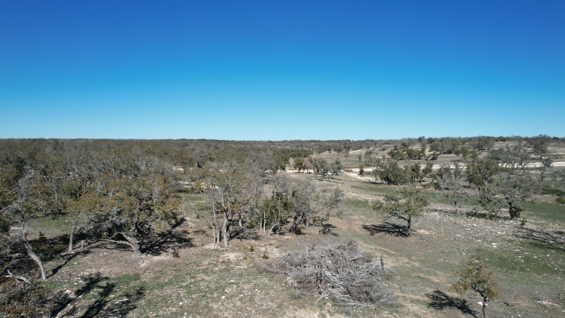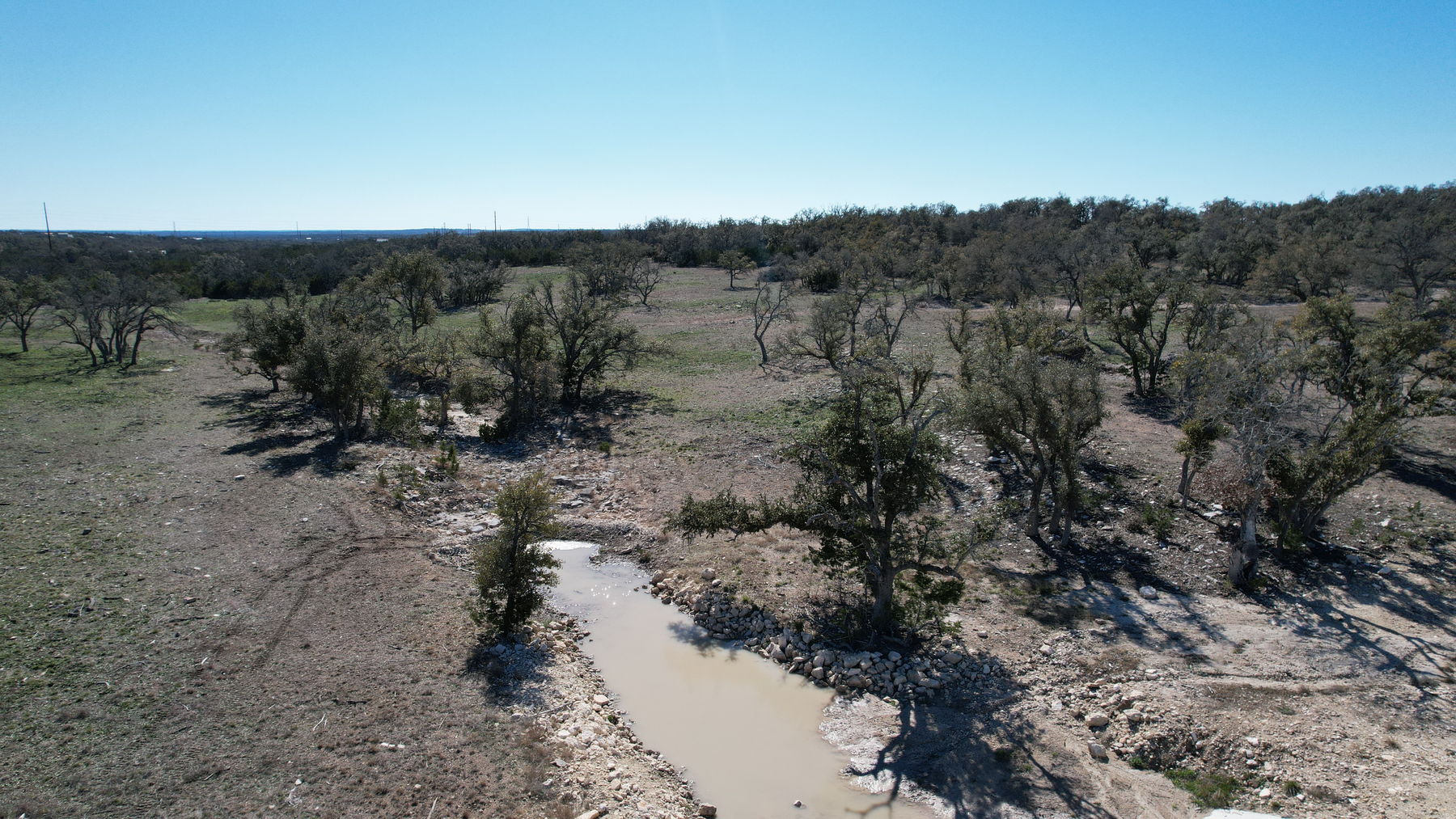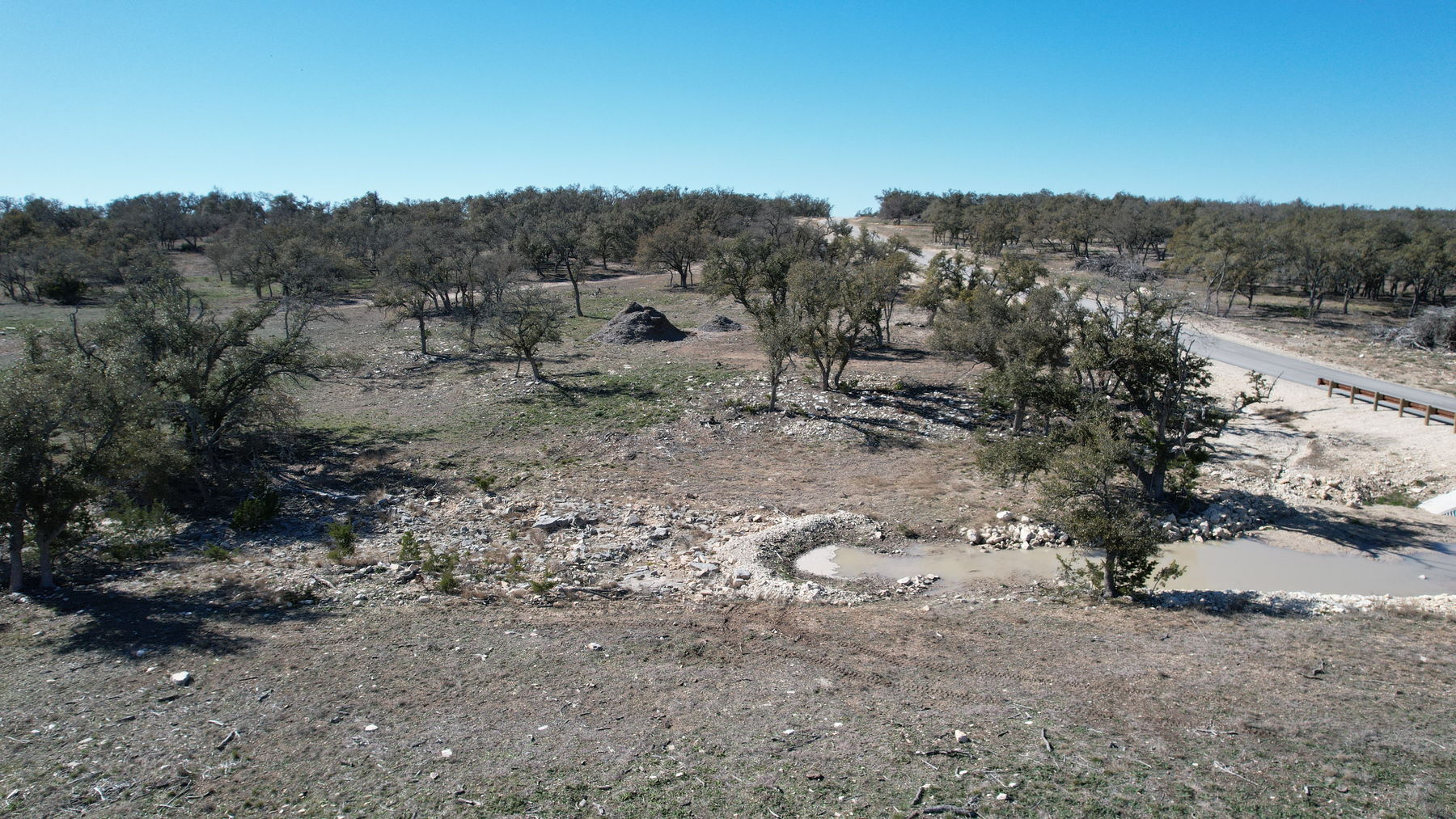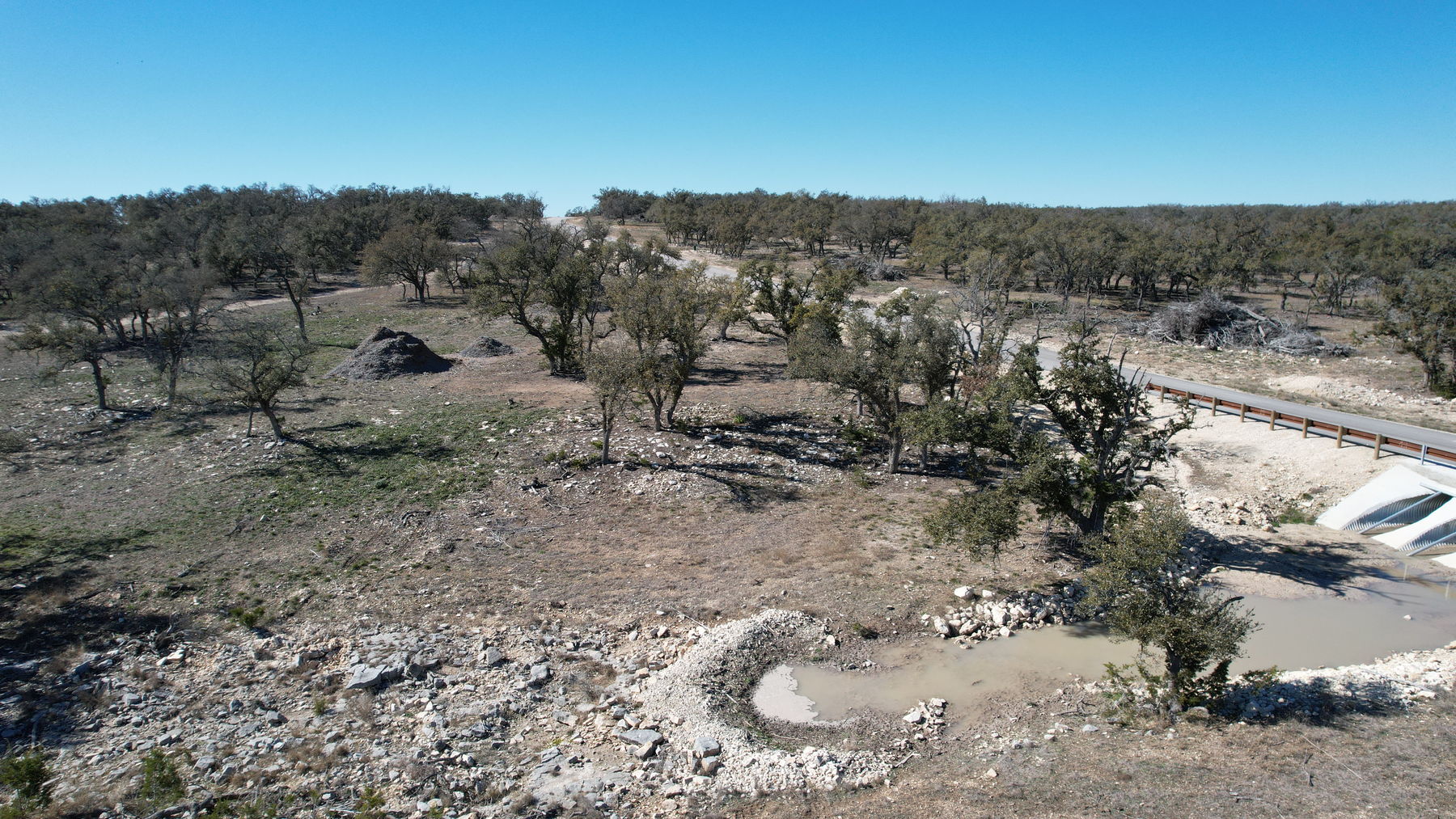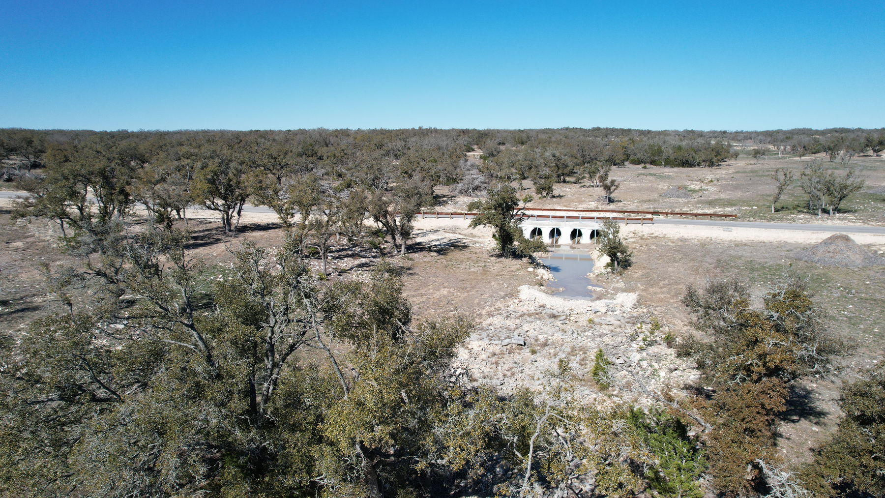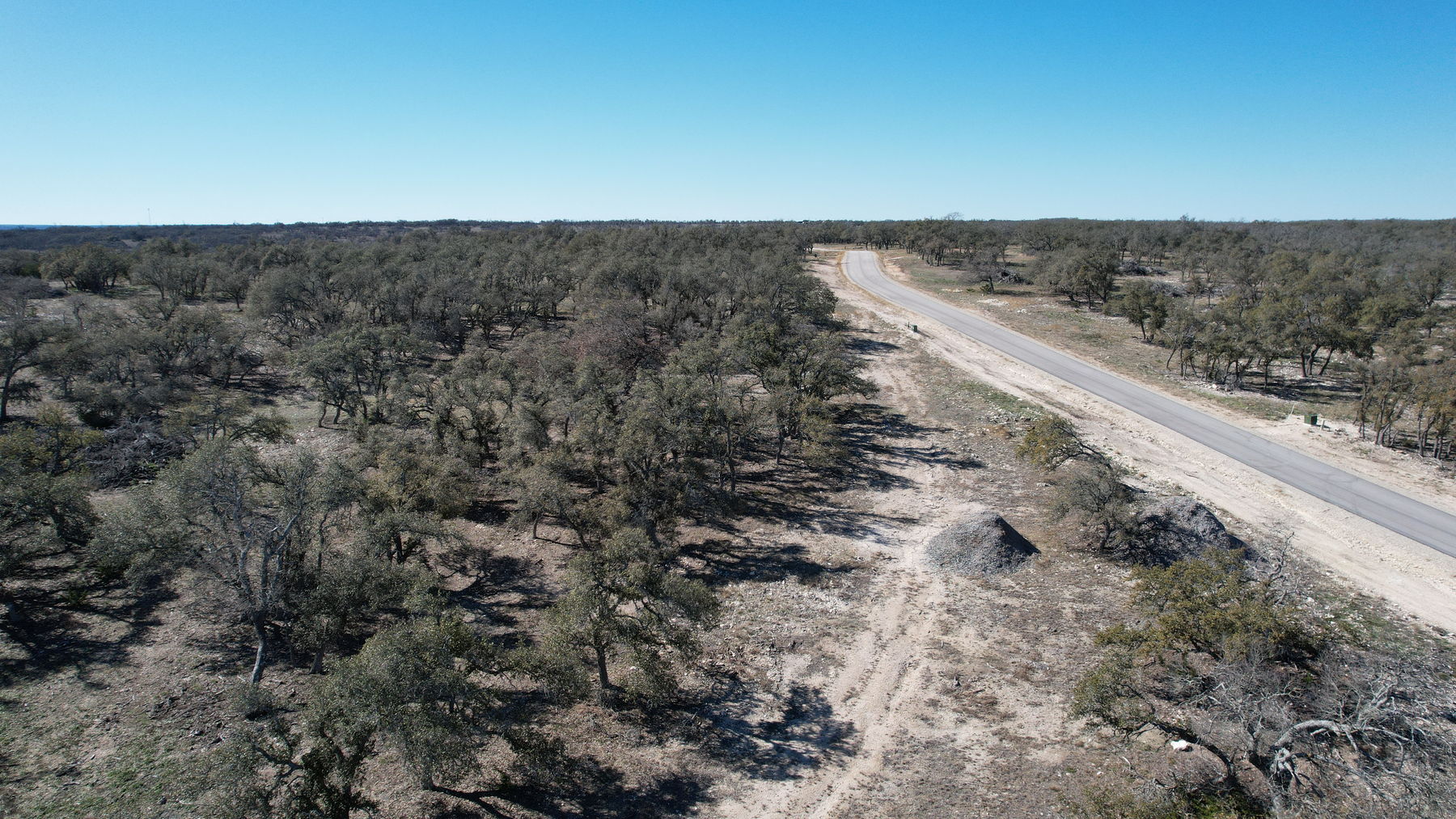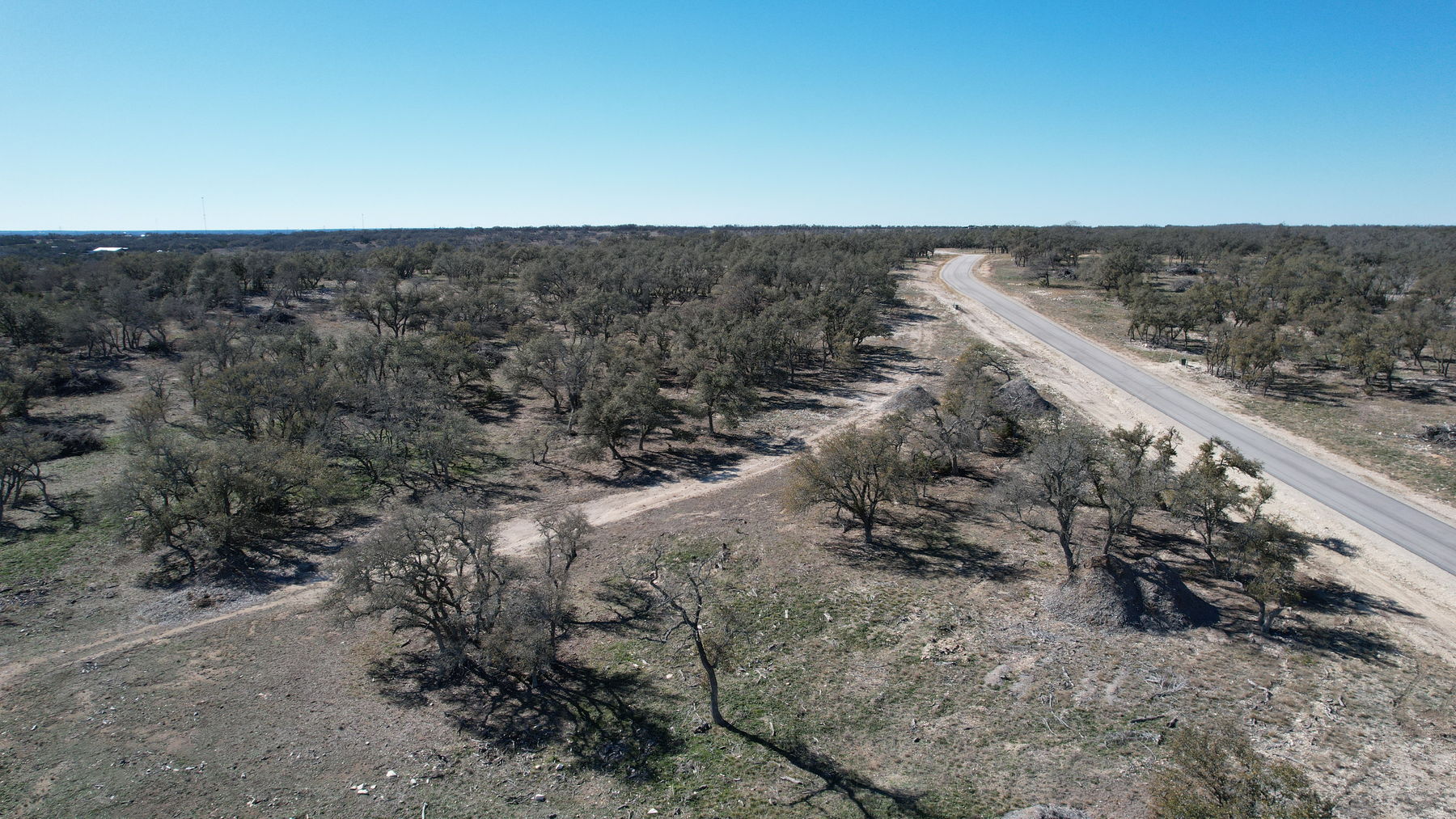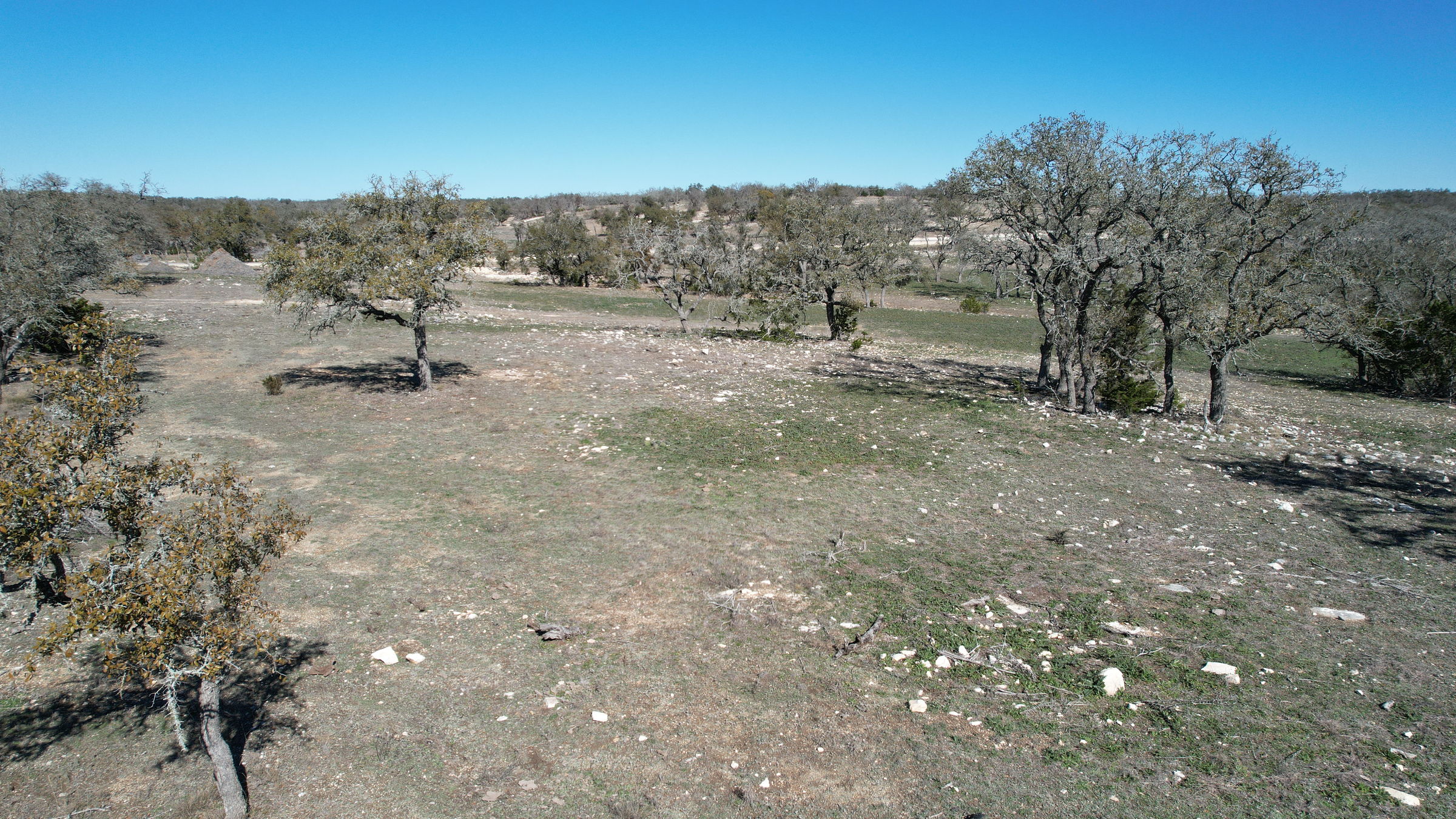
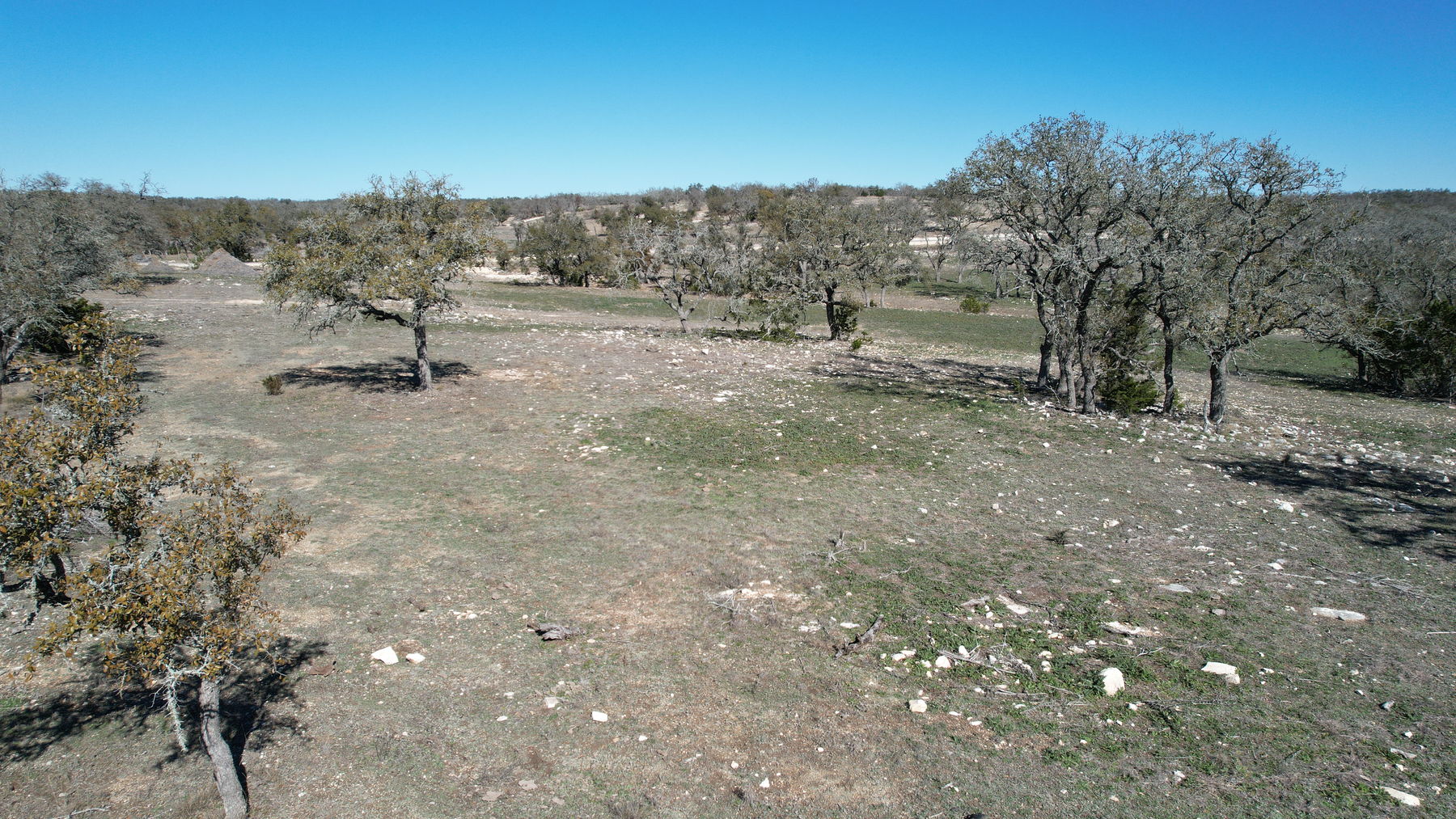
Low aerial across open ground at Lot 34 N Brooklyn Dr, with scattered mature live oaks, limestone breaking the surface and Hill Country beyond under a clear winter sky

Kerr County · Harper, Texas · Hideout Ranch

Lot 34 N Brooklyn Dr

Ten acres of open Hill Country ground under scattered live oaks

10.01 acres in Hideout Ranch, west of Kerrville and just off I‑10 at Harper. Open pasture, mature live oaks in stands, limestone breaking through, and a rocky drainage across the low ground. Nothing is built on it. The homeowners’ association is mandatory at $1,000 a year, the roads are private, and there is no water or septic on the tract.

$250,000
List price
10.01 acres
Per the recorded legal description
$24,975
Per acre
L122494A
MLS number

The land

Ten acres of workable Hill Country, seen in February.

Open ground with scattered mature live oaks, thicker cover in stands, limestone at the surface in places, and ground that falls away gently to the north toward a rocky drainage. Nothing is built on it.

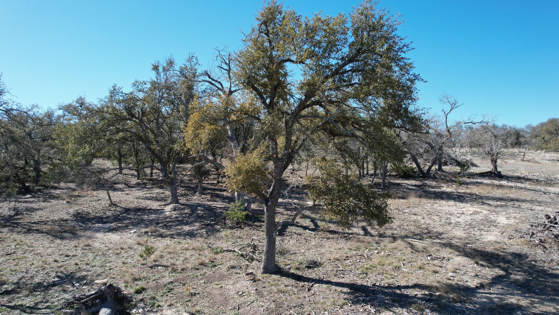
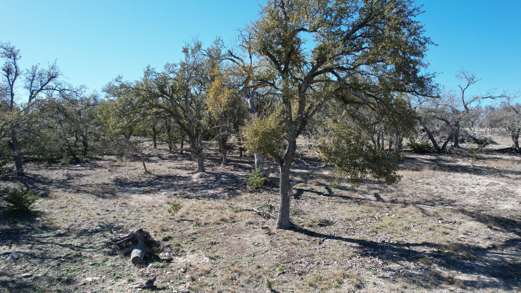
What the photographs actually show, in the words of the person who took them apart frame by frame. The oaks are real: live oaks carrying full green canopy through February, growing in stands rather than as single specimens. Much of the rest of the tree cover in the wide frames is bare deciduous canopy over dormant winter ground, and one green tree does not stand in for the tract. Between the trees the ground is open, gently rolling, and grassed with winter cover, with limestone breaking the surface in patches — typical for this part of Kerr County.

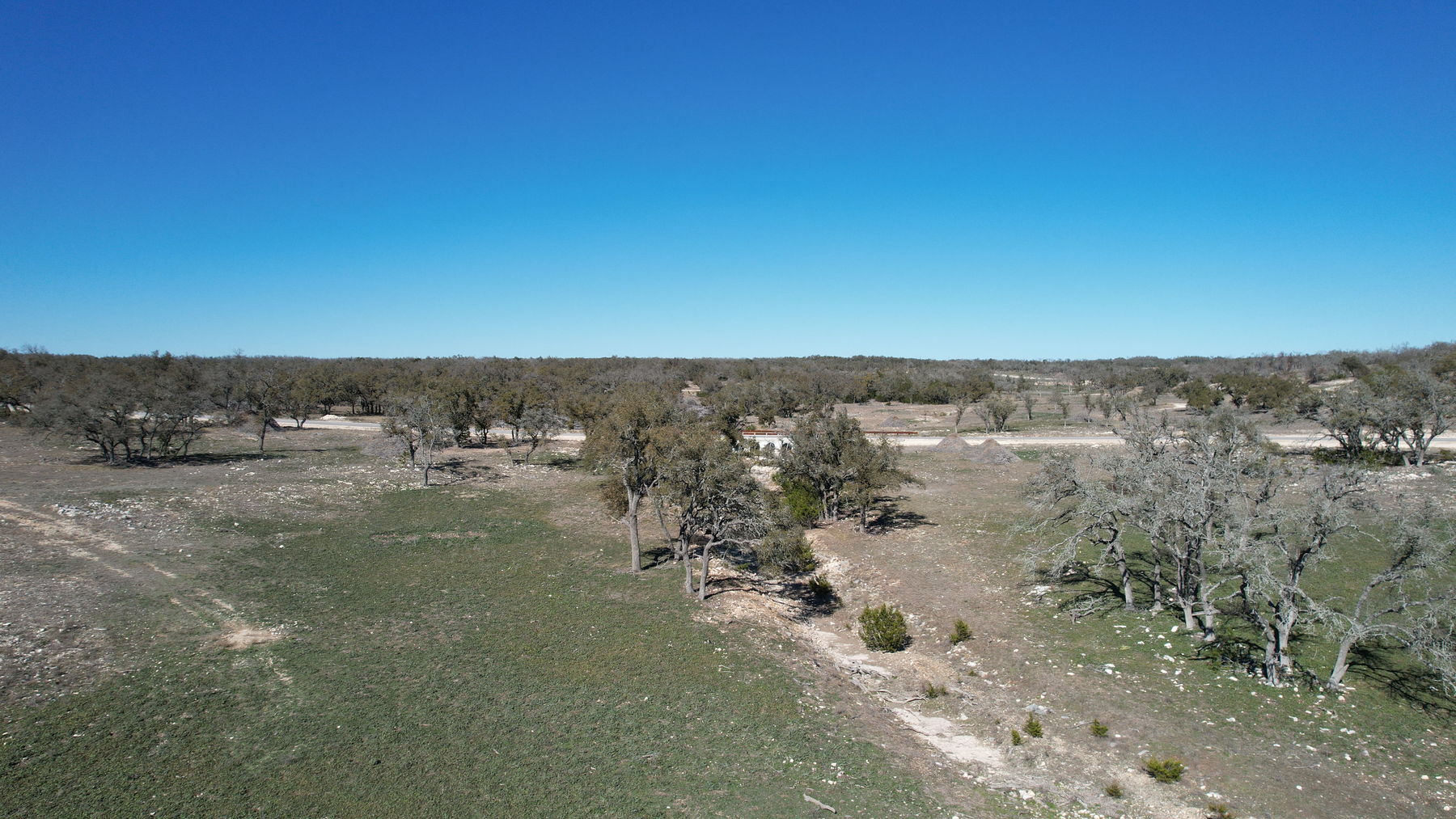
There is water on the low ground, and it is worth being exact about what it is. A drainage crosses the low part of the property, and its channel is genuinely edged with loose stone. In these February frames the water in it is shallow, silty and tan — standing water in a rocky draw, immediately below the point where the subdivision road crosses on a four-barrel concrete culvert. It is a draw. It is not a creek and it is not a pond — the deck and the feature sheet say the same, and we would rather you heard it from us than found it out on the drive home. Flow there is seasonal, not year-round. The concrete apron and the guardrail visible at the crossing are the road’s, not an improvement on this tract. Come and look at it in a wet month and in a dry one before you decide what it is worth to you.

Access is a private subdivision road, and the roads here are owner-maintained. The tract sits on a chip-and-seal surfaced road inside Hideout Ranch. The recorded deed carries the covenant in capital letters: the streets and roadways of the platted subdivision are privately maintained by the property owners, and Kerr County is not responsible for maintaining or repairing them. The subdivision is gated. This tract has no gate and no entrance of its own — it is a vacant ten-acre lot with a caliche drive cut leaving the paved road at the edge of the tree line.

Utilities are a build cost, not an existing service. There is no water and no sewer on the tract. A well and an on-site sewage system are the buyer’s to drill and to build. Electricity is available in the subdivision through Central Texas Electric Co-op, and the developer’s own information statement — published on this page — names Windstream Fiber as the internet provider. Confirm all of it with the providers before you write.

The listing came to market in February 2026 and is offered at $250,000, which is $24,975 an acre.

  • 10.01 acres · MLS #L122494A · Hideout Ranch, Kerr County · listed February 2026.
  • Homeowners’ association is mandatory — $1,000 a year. Private, owner-maintained roads.
  • No water, no septic, no gas on the tract · electricity available · well and on-site sewage are the buyer’s cost.
  • Single-family residential use under recorded restrictions · no mobile homes · 1,600 sq ft minimum on a residence · the full recorded instrument is published on this page.
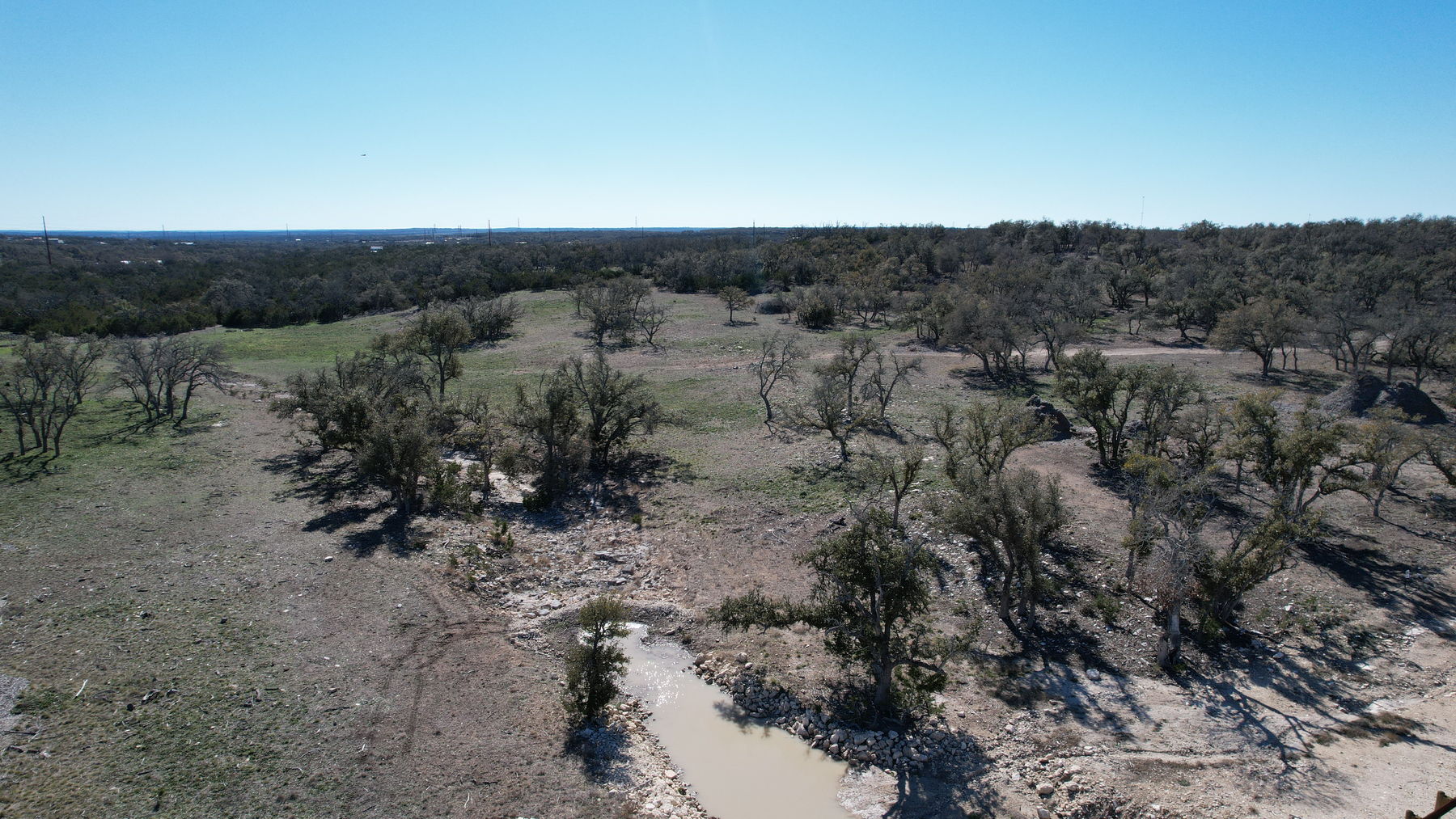
Aerial looking out across the low ground of the property, with the rocky drainage crossing the foreground and Hill Country beyond
Looking out across the low ground, with the drainage crossing the foreground and hill country beyond. Photography 2024-02-12. Winter conditions; seasonal appearance varies.

Property snapshot

What’s here, in plain numbers.

The land
10.01 acresHideout Ranch Lot 34, per the recorded legal description · open pasture and oak cover · gently rolling with a drainage across the low ground · nothing built on it
Price
$250,000$24,975 an acre · listed February 2026 · cash, conventional or Texas Vet per the listing record
Homeowners’ association
$1,000 a year — mandatoryMembership is not optional and neither is the assessment. It runs annually and it becomes a lien on the lot if unpaid. The recorded Declaration lets the association set the figure each year, so confirm the current amount and any special assessment with the association before you write.
Taxes
$1,336.27The appraisal district’s figure without exemptions — the buyer-relevant number, from the confirmed listing record, source Kerr CAD. Verify with Kerr CAD, and read the rollback note in the due-diligence list below.
Water & sewer
None on the tractNo municipal water and no municipal sewer. A well and an on-site sewage system are the buyer’s to drill and to build, and depth and yield vary. This is stated in the developer’s own information statement, published on this page.
Electricity & internet
AvailableElectricity available in the subdivision through Central Texas Electric Co-op. The developer’s information statement names Windstream Fiber for internet. No gas. Confirm availability, capacity and connection costs with each provider.
Access
Private subdivision roadChip-and-seal surface. The recorded deed states the subdivision’s streets are privately maintained by the property owners and that Kerr County is not responsible for their maintenance or repair. The subdivision is gated; this tract has no gate of its own.
Restrictions
Recorded & enforcedSingle-family residential use, no mobile homes, a 1,600 sq ft minimum on a residence and 800 sq ft on a guest house, cabin or barndominium, and no more than four structures on a lot. Manufactured housing is not permitted. The full recorded instrument is published on this page.
Legal & account
Hideout Ranch Lot 34Legal description HIDEOUT RANCH LOT 34, ACRES 10.01 · recorded deed Kerr County Doc 22-00529, plat Doc 22-00306 · Kerr CAD Property ID 540970 · Harper, Kerr County, Texas

The fine print on these numbers

Figures are from the confirmed listing record for MLS #L122494A, Active, listed February 2026, at the current list price of $250,000. Acreage is 10.01 as it appears in the recorded legal description, and the price per acre is derived from those two figures and nothing else. The address is Lot 34 N Brooklyn Dr, Harper, Texas 78631, in Kerr County — the MLS area field carries a different place name, which is an area designation and not the city.

No building setback, height or lot-coverage figure is printed anywhere on this page. Those live in the recorded plat sheet and the recorded restrictions, both published here, which is the right home for them. The tax figure is the appraisal district’s estimate without exemptions; any valuation the current owner holds does not transfer. A buyer should independently verify acreage, boundaries, easements, taxes, restrictions, permitted use, association dues and utilities. All measurements are approximate, and boundary lines are approximate and for illustration only — not a survey.

Restrictions & the association — read this before you write

What you can build here, and what you owe every year.

This is a platted subdivision with recorded restrictions and a mandatory homeowners’ association. Both matter more on a lot like this than on raw acreage, so here is what the recorded instruments say, in plain words, with the documents themselves published below.

The association is mandatory and the assessment is $1,000 a year. Every owner becomes a member on taking title — it is a covenant that runs with the land, not a club you join. The assessment is a permanent charge and a continuing lien on the lot, and it is the owner’s personal obligation as well. The recorded Declaration has the association set the annual figure each year, and it allows special assessments on top in a year the association votes for one. Confirm the current annual amount, the payment date and any special assessment or transfer fee with the association before you write an offer.

What can go on the lot. Single-family residential use. A residence built after 1 November 2021 has to be at least 1,600 square feet of living area — heated and cooled space, not counting porches, breezeways, carports, garages or basements. A guest house, cabin, barndominium or short-term rental has to be at least 800 square feet on the same measure. No mobile homes, and the listing record separately states that manufactured housing is not permitted. The total number of residences and additional structures on a lot cannot exceed four, and an architectural control committee reviews plans before building.

What the land can be used for. The Declaration prohibits commercial use, then carves out three exceptions in its own words: raising livestock, poultry or other animals except swine; raising agricultural crops; and operating a short-term rental, which it defines as lodging within the principal dwelling or in a separate guest house. Perimeter fences must be new material built to professional standards.

Firearms — the rule, without our reading of it. The Declaration prohibits the discharge of firearms, and states that the prohibition does not apply to an owner holding title to a lot or lots which in the aggregate exceed ten acres. It permits shooting varmints, predators or wildlife to protect the property, and harvesting wildlife by bow or crossbow. It prohibits shooting ranges and persistent discharge of guns outright. Whether that exception reaches this tract is a question for the association and for your own attorney; this page draws no conclusion and makes no representation about it.

The roads are private and they are yours to help maintain. The recorded deed states in capital letters that the subdivision’s streets and roadways are privately maintained by the property owners, that Kerr County is not responsible for maintaining or repairing them, and that an owner waives the right to demand that it does. Maintenance is governed by the recorded covenants and funded through the association.

So: read the recorded restrictions and the bylaws, and talk to the association, before you write an offer. They are the authority on what this subdivision allows on this lot. Nothing on this page is legal advice and nothing on it predicts what the association or the architectural committee would decide.

“Lots will be limited to Single Family residential use, there shall be no mobile homes installed on the property. Additional structures are allowed on the property such as cabins, barndominiums, short-term rentals, guest houses, detached garages, and storage buildings. They must be built and maintained in the same fashion as a single family residence. The total number of single family residences and additional structures erected on a Lot shall not exceed four.”

Declaration of Restrictions, Hideout Ranch Subdivision — Kerr County Doc. 22-00505, paragraph 1

“Single-family residences erected or constructed subsequent to November 1, 2021 shall contain a minimum of 1,600 square feet of living area. All other guest homes, cabins, barndominiums and short-term rentals erected or constructed subsequent to November 1, 2021 shall contain a minimum of 800 square feet of living area.”

Declaration of Restrictions — paragraph 2

The three governing documents, published in full

The recorded restrictions — the complete Declaration of Restrictions, Conditions, Easements, Covenants, Agreements, Liens and Charges for the Hideout Ranch Subdivision, as recorded in Kerr County under Document No. 22-00505, including its metes-and-bounds exhibit. Open the PDF.

The association bylaws — the bylaws of the Hideout Ranch Home Owners Association, Inc., covering meetings, voting, the board and the assessment machinery. Open the PDF.

The developer’s vital information statement — Addendum “A” for The Hideout, naming the utility providers and stating plainly that municipal water and sewer are not available and that a well and an on-site sewage system are the purchaser’s responsibility. Open the PDF.

Photographs

Twelve frames, all from the air, in February.

Twelve photographs of the property, published exactly as delivered — resized and stripped of metadata, with no colour grade, no sky replacement, no sharpening and no retouching of any kind.

A word on coverage, so nobody is surprised on site. This shoot is entirely aerial. Every frame was taken from a drone between about two and twenty metres up. There is no ground-level frame anywhere in the set — no view from the road as you would first see it on arrival, no gate, no entrance, no sign, no corner and no survey pin or stake. Nothing was invented to fill those gaps and nothing was retouched. The documents further down the page — the recorded deed with its plat sheet, and the subdivision lot map — are what answer the spatial questions, and walking it is what answers the rest.

About these photographs, and the limits of this set

Photography 2024-02-12. Winter conditions; seasonal appearance varies. That is the real capture date, from the camera’s own metadata, and it is two years before this listing cycle. The ground is dormant and the deciduous canopy is bare in these frames. In another season the same ground looks different, and so does the water: what is in these pictures is shallow, silty, seasonal standing water in a rocky drainage below the road crossing, and how much of it there is depends on when it last rained.

Twelve frames from one aerial shoot — that is the whole publishable set. The shoot produced twenty-two real compositions; the rest of the files are bracketed exposures of the same twenty-two, plus three panoramas that are not photographs of this kind. Two compositions were rejected: one shows a vehicle parked on the road shoulder, and one shows a structure that stands outside this tract and does not convey. A street-level photograph of the subdivision entrance found in the file was excluded because we cannot establish that it is ours to publish. No frame was retouched, graded or enhanced — where a frame could not be published it was dropped rather than edited.

What this set does not show: no ground-level view of any kind; no gate and no entrance; no view from the road on arrival; no sign; no corner; no survey pin or stake; no well, tank, meter or utility connection point; and no second season. There is no video tour and no 3D tour for this property. There is also no photograph anywhere in this set with a property line drawn on it. An aerial with an approximate boundary drawn over it is published further down under Location, but it is a drawn illustration and not one of these twelve frames, and it is not part of this gallery. Boundary lines are approximate and for illustration only — not a survey. Nothing in these frames should be read as showing where a property line falls; walk the ground and have a survey made.

Location

Harper, TX 78631 · Kerr County · Hideout Ranch

West of Kerrville on the I‑10 corridor, in a platted acreage subdivision that straddles the Kerr and Gillespie county line. This lot is on the Kerr County side.

Harper, TX 78631Kerr County · Hideout Ranch subdivision
Lot 34Hideout Ranch Lot 34, Acres 10.01
Private roadsChip-and-seal, maintained by the property owners
SchoolsHarper — buyer to verify with the district
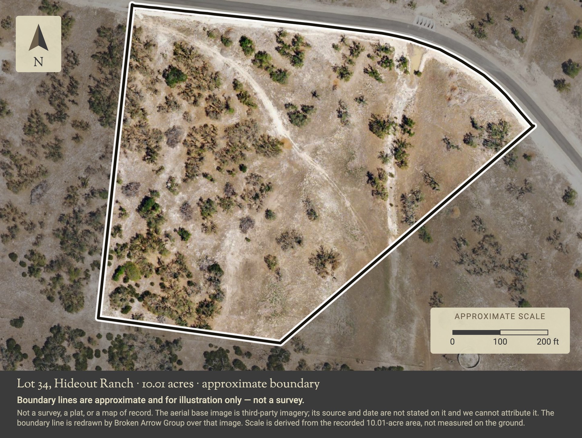
Illustration — not a photograph, not a survey Aerial view of Lot 34 in Hideout Ranch with an approximate boundary line drawn around the ten acres, a north arrow and a two hundred foot scale bar. The subdivision road runs along the north-east side. Boundary lines are approximate and for illustration only, and this is not a survey.
The approximate shape of the ten acres. The boundary line here is drawn by us over an aerial image, to give you a sense of how the lot sits against the road before you walk it. Boundary lines are approximate and for illustration only — not a survey. It is not a survey, not a plat, and not a map of record, and nothing on it should be measured or relied on. The aerial base is third-party imagery: its source and date are not stated on it and we cannot attribute it — we can only tell you that we did not shoot it. The scale bar is derived from the recorded 10.01-acre area, not measured on the ground. For the instrument that does carry bearings and distances, see the plat sheet on the last page of the recorded deed below.

What is published about the shape of the ground — and what is not

Two documents on this page show where this lot sits. The recorded deed carries the surveyor’s subdivision plat sheet as its final page — that is the plat of record, Kerr County Document No. 22-00306, with the lots, the bearings and distances and the surveyor’s own notes on it. The subdivision lot map is the developer’s numbered sales map of the whole of The Hideout, and it carries its own warning on its face that it is for information purposes and may not be suitable for legal, engineering or surveying use. It is not a plat of record and it is not a survey, and the ring drawn around this part of the subdivision is a hand mark on the copy in our file, not part of the published map.

The illustration above is the only image on this page with a line drawn on it, and no photograph here shows a property line. That line is ours, drawn over an aerial base we cannot attribute, and it is approximate. Boundary lines are approximate and for illustration only — not a survey. A buyer should have a current survey made and should verify boundaries, acreage and easements of record independently.

There is no wider locator or context map on this page, and that is deliberate rather than an omission. We have no basemap for a zoomed-out view whose source we could name, and we would rather publish nothing than publish a map we cannot stand behind. For where The Hideout sits as a whole, the subdivision lot map above shows the road loop, the two gated entrances and the county line.

Due diligence

What a buyer should verify.

These are the things on this property a buyer will want to look into. They are on the page because a buyer would rather read them here than find them later.

Documents on file

Seven documents are published on this page: the seller’s offer instructions, the recorded deed with its plat sheet, the recorded subdivision restrictions, the association bylaws, the developer’s vital information statement, the subdivision road disclosure and the subdivision lot map. One of the seven — the road disclosure — is published as a redacted copy with a signature painted out, and it says so on its own face. Nothing else on this page has been altered. They are listed with measured page counts and file sizes under Showings & how to offer. Anything else on file is available from the listing agent on request — email frontdesk@brokenarrowrealtygroup.com or call 830-383-2026.

Take it with you

The presentation and the feature sheet.

The property laid out to read on a phone or print — the numbers, the ground, the restrictions and the association, the photographs and their limits, the due-diligence list and the offer mechanics. The feature sheet is the same property on one page, sized to print or hand across a table.

Showings & how to offer

How to see it, and how to write on it.

Showing instructions

  • An appointment is required. Contact the listing agent to arrange access before you go out. The subdivision is gated and the roads inside it are private.
  • It is ten acres of open ground with nothing built on it. Allow time to walk the whole of it, including the low ground and the drainage, and wear boots for it.
  • Read the restrictions and the association documents before the visit, not after. They set what can be built here and what is owed every year, and both are published on this page.
  • Questions on the packet: email frontdesk@brokenarrowrealtygroup.com or call or text 830-383-2026.

How to submit an offer

The seller’s offer instructions are published with this listing; read them before you write. This applies to buyer’s agents only. Unrepresented buyers can contact Broken Arrow Group directly at 830-383-2026.

  • Email offers to frontdesk@brokenarrowrealtygroup.com, then call or text 830-383-2026 so we know it landed.
  • Do the association homework first. If your plans depend on what can be built here or on what the assessment will be, settle it with the association before you write — not after.

Documents

  • Seller’s offer instructions (PDF, 1 page, 0.2 MB) The seller’s own instructions for submitting an offer — option period preference, earnest money, proof of funds and the title company — published as issued and unmodified. Read it before you write. This applies to buyer’s agents only; unrepresented buyers can contact us directly at 830-383-2026.
  • Recorded deed, with the plat sheet (PDF, 6 pages, 3.9 MB) The recorded special warranty deed for this lot, Kerr County Document No. 22-00529, published as issued from the public record. It carries the legal description, the exceptions to conveyance — including mineral interests reserved by prior owners — the private-road covenant and the agricultural rollback provision. Its final page is the surveyor’s recorded plat sheet, Document No. 22-00306. A recorded deed is a public instrument and is not a title commitment.
  • Recorded subdivision restrictions (PDF, 51 pages, 2.2 MB) The complete Declaration of Restrictions, Conditions, Easements, Covenants, Agreements, Liens and Charges for the Hideout Ranch Subdivision, recorded in Kerr County under Document No. 22-00505, including the metes-and-bounds exhibit. This is the instrument that sets use, minimum size, structure counts, architectural review and the assessment machinery — everything this page says about restrictions comes from it.
  • Association bylaws (PDF, 13 pages, 0.2 MB) The bylaws of the Hideout Ranch Home Owners Association, Inc. — membership, annual and special meetings, voting, the executive board, officers and the association’s powers. Read this beside the recorded restrictions; between them they are how the $1,000 annual assessment is set, collected and enforced.
  • Developer’s vital information statement (PDF, 1 page, 0.8 MB) Addendum “A” for The Hideout, issued by the developer at the time the subdivision was sold. It names the electricity and internet providers and states plainly that municipal water and sewer are not available and that a well and an on-site sewage system are the purchaser’s responsibility. It also records that the tract was rendered as open-space agricultural land at that time and that maintaining that valuation is the owner’s responsibility — confirm the current position with Kerr CAD.
  • Subdivision road disclosure — redacted copy (PDF, 1 page, 0.9 MB) The developer’s road disclosure for The Hideout. It states that the rights-of-way and easements shown on the plat are private roads and are not for the general public’s use, that maintenance of them falls on the property owners under the recorded covenants, and that no representation is made that the State of Texas or Kerr or Gillespie County will ever adopt or maintain them. Read it beside the private-road covenant in the recorded deed. This copy has been altered: a handwritten signature has been painted out of the page image, and the document says so on its face. Nothing else was changed — the text, the form and the signature date are as issued, and the unaltered original is held in the listing file.
  • Subdivision lot map — The Hideout (PDF, 1 page, 0.7 MB) The developer’s numbered sales map of the whole subdivision, showing the lot layout, the road loop, the two gated entrances and the county line. It is not a plat of record and it is not a survey — it carries the publisher’s own warning that it is for information purposes and may not be suitable for legal, engineering or surveying use, and the ring on it is a hand mark on the copy in our file. Boundary lines are approximate and for illustration only — not a survey. For the plat of record, see the final page of the recorded deed above.
  • The full presentation (PDF, 9 pages, 9.3 MB) The whole property, laid out to print or forward.
  • Feature sheet (PDF, 1 page, 4.2 MB) The property on one page — the numbers, the association note and the verify list.

These are the documents published for this property. The recorded deed, the recorded restrictions, the bylaws and the developer’s statement are provided for reference only — they are not a title commitment and none of them is a current survey, and a buyer should have title examined and a survey made independently. Anything else on file is available from the listing agent on request.

There is no video tour and no 3D tour for this property — neither exists in a publishable form and nothing was substituted for either. The aerial with an approximate boundary drawn on it, under Location, is an illustration we drew; it is not a survey, a plat or a map of record. This is raw, unimproved land: nothing is built on it and nothing stands on it that conveys. What conveys is the land itself, as confirmed in the contract.

Come take a look

Let’s go take a look.

You bring the dream. We have the land.

Call or text and we’ll set a time to walk it. Twelve aerial frames from one February afternoon only go so far on ten acres — you want to stand on the high ground, walk down to the drainage and see how the oaks sit. And if what you have in mind depends on the restrictions or on what the association charges, tell us early so we can get you the answer before you write.

David Hughes
TREC #501321
Jayden Hughes
TREC #728099