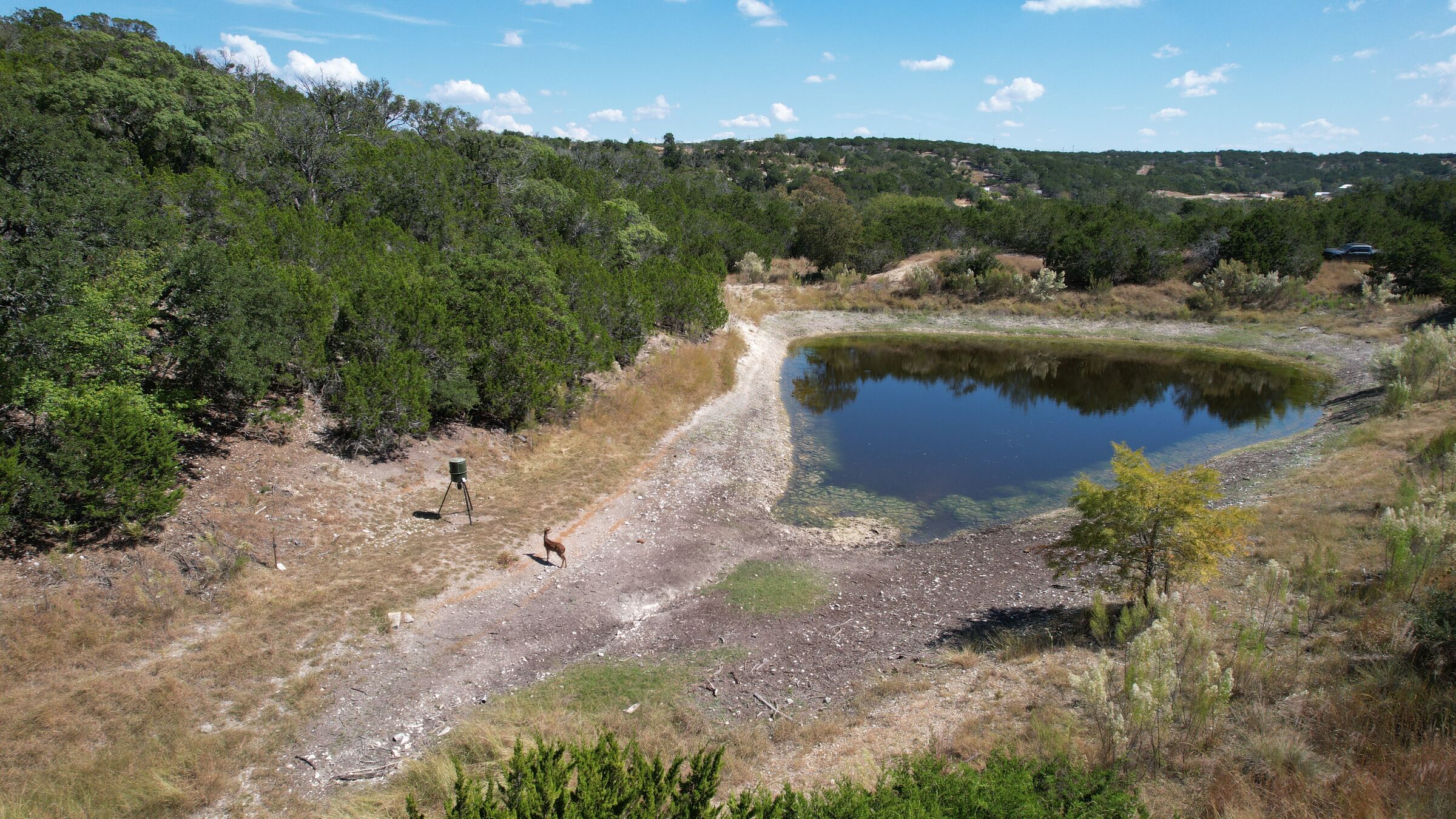
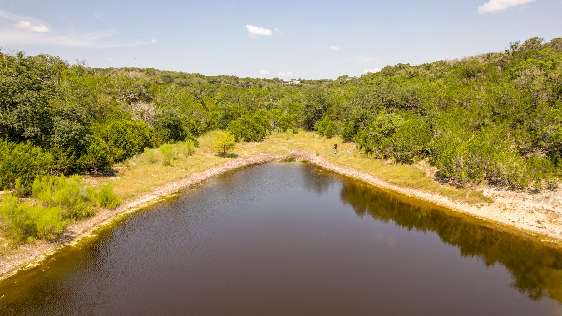
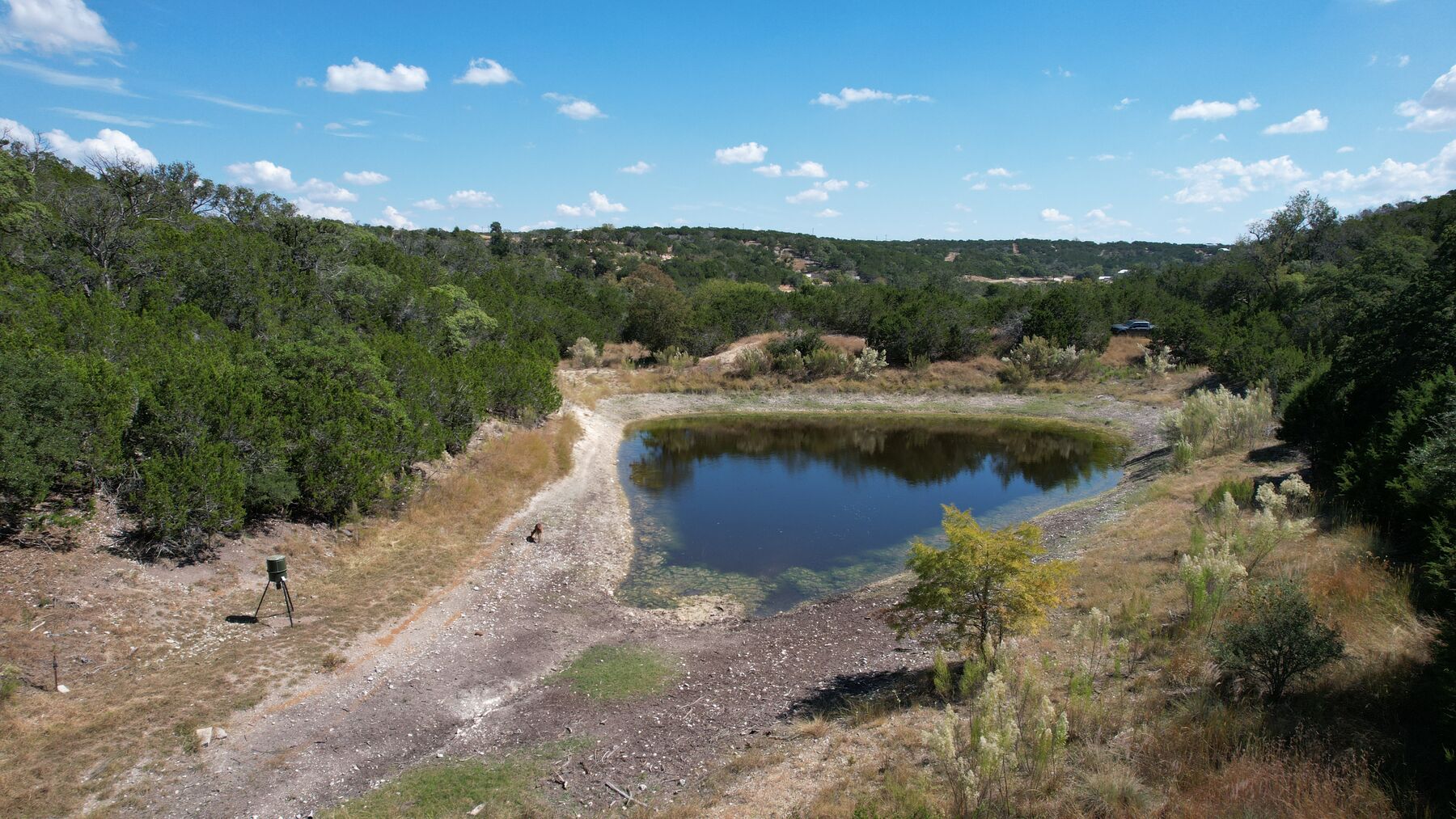
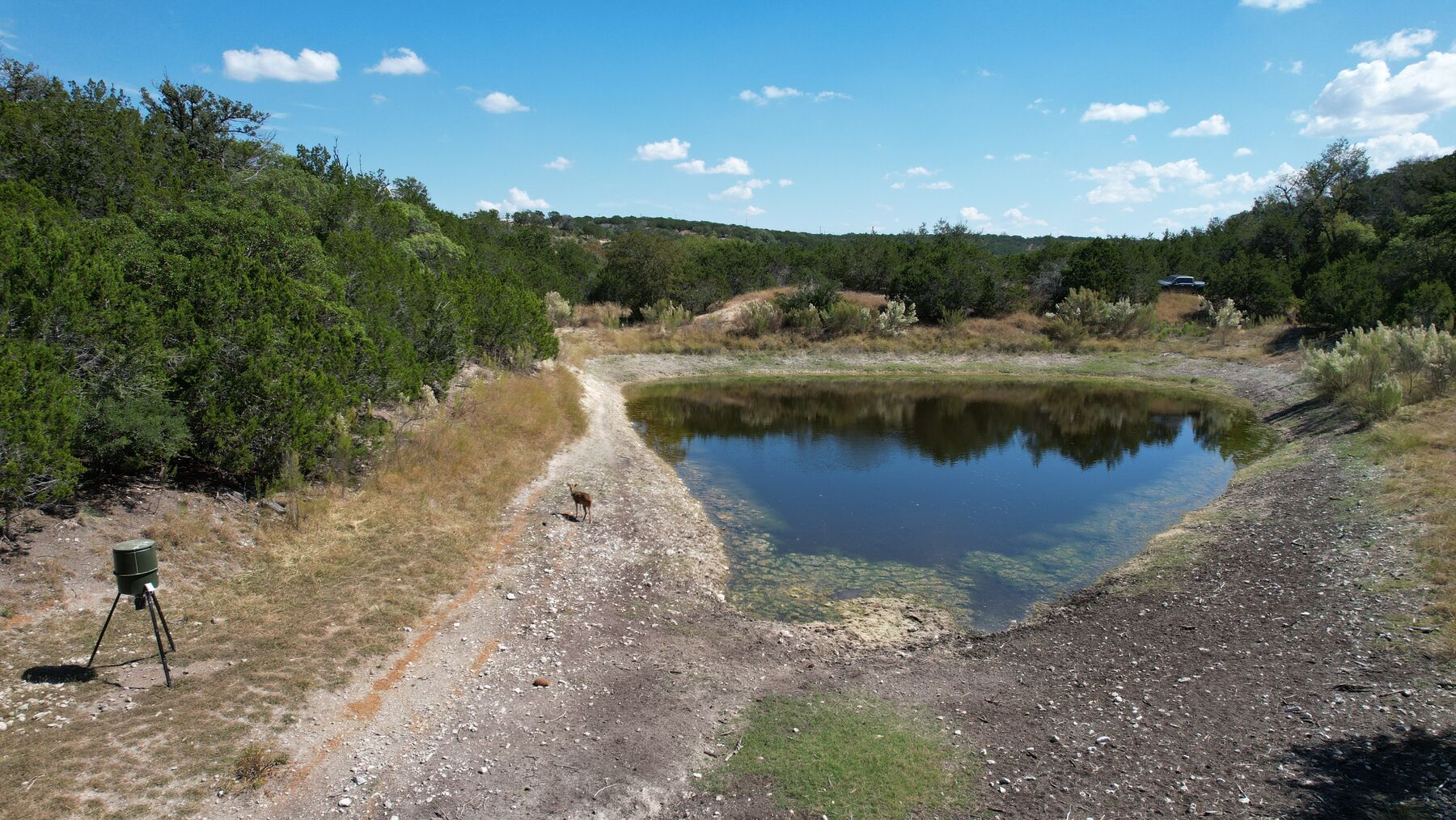
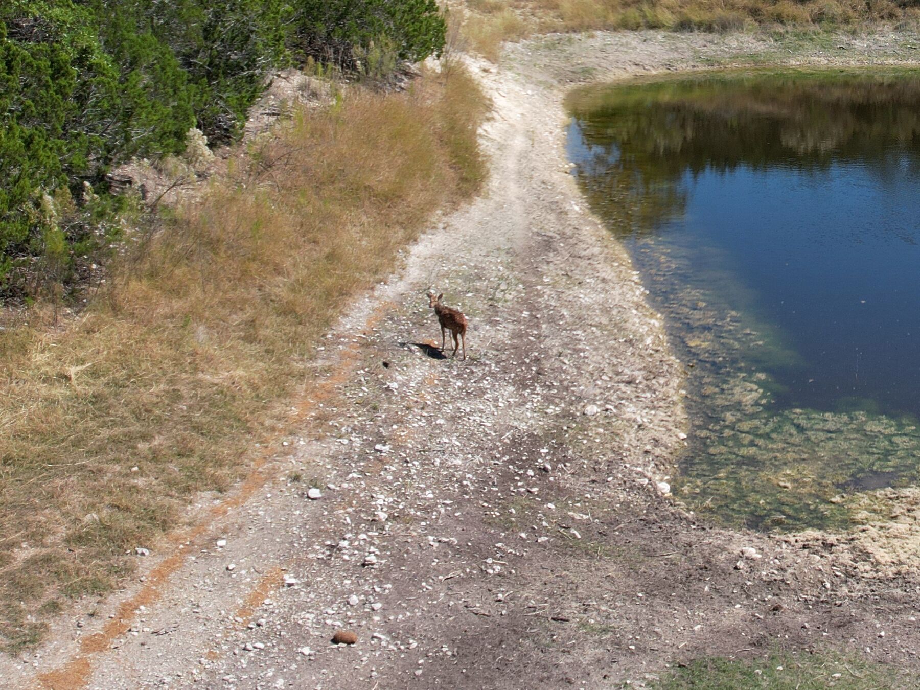
The seasonal pond at 230 Marshall Dr seen from the air on 10 October 2025 — water in a bowl below the west ridge with pale exposed shoreline ringing it, a caliche track down the near side, and cedar and live oak closing the far side

Kerr County · Kerrville, Texas · Kerrville South II

230 Marshall Dr

Sixteen and three-quarter wooded acres, around a seasonal pond

16.77 acres of wooded, secluded Hill Country south of Kerrville, built around a pond that sits in a bowl below the west ridge. The pond is seasonal — its level rises and falls through the year, and two dated shoots on this page show it at both.

$299,000
List price
16.77 acres
Wooded and secluded
$17,829
Per acre
F120128A
MLS number

Video tour

See the pond bowl before you drive out.

An aerial pass over the tract, flown 10 October 2025 — about forty-eight seconds, in over the tree cover, out to the far ridge line, then down into the bowl where the pond sits with its shoreline exposed.

Flown 10 October 2025 — autumn conditions. The pond is seasonal and its level varies through the year; what the tour shows is the level on that day. Nothing in it was graded into another season or another water level. No boundary line is drawn in the tour, and no boundary line is drawn on any photograph on this page.

What is on the land, and what does not convey

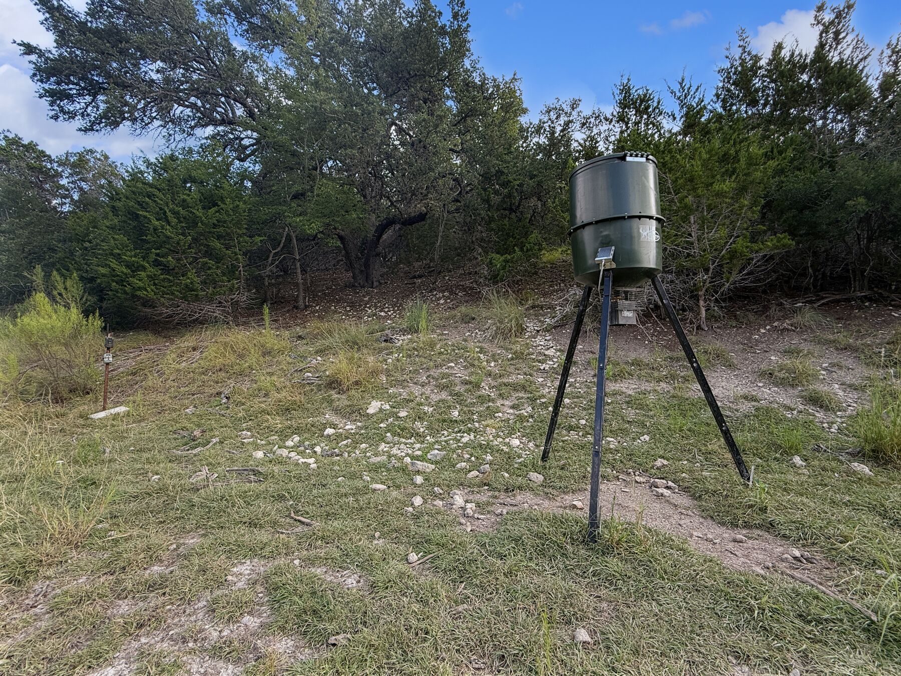
The feeder, the box blind and the pop-up ground blind do not convey. Three hunting improvements stand on the tract and all three appear in the tour and in the photographs — a tripod barrel feeder on the flat by the pond, a box blind set back in the cedar across the water, and a camouflage pop-up ground blind tucked into the brush at the pond’s edge. None of the three is included in the sale. What conveys is the land and what is fixed to it; nothing else conveys except as confirmed in the contract.

Two other things are on camera and are named here rather than edited out. A parked pickup sits on the two-track above the far bank and is visible twice in the tour, briefly and at a distance. Distant rooflines of the surrounding Kerrville South subdivision show along the far ridge in the wide passes. Neither is part of the offering, neither was cropped or removed, and nothing in the tour promises isolation — “secluded” is the listing record’s word for the tract itself.

The place

16.77 wooded acres around a seasonal pond.

Marshall Drive runs into the Kerrville South country south of town. Sixteen and three-quarter acres sit here — wooded, secluded, with an exceptional view out to the ridge line and a pond in the bowl at the middle of it.

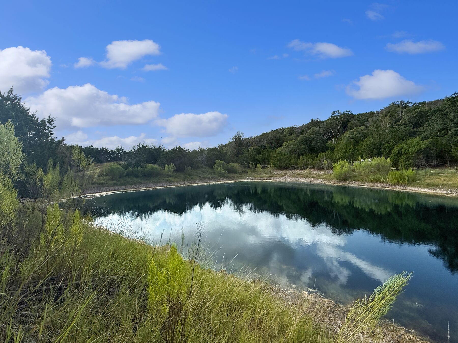
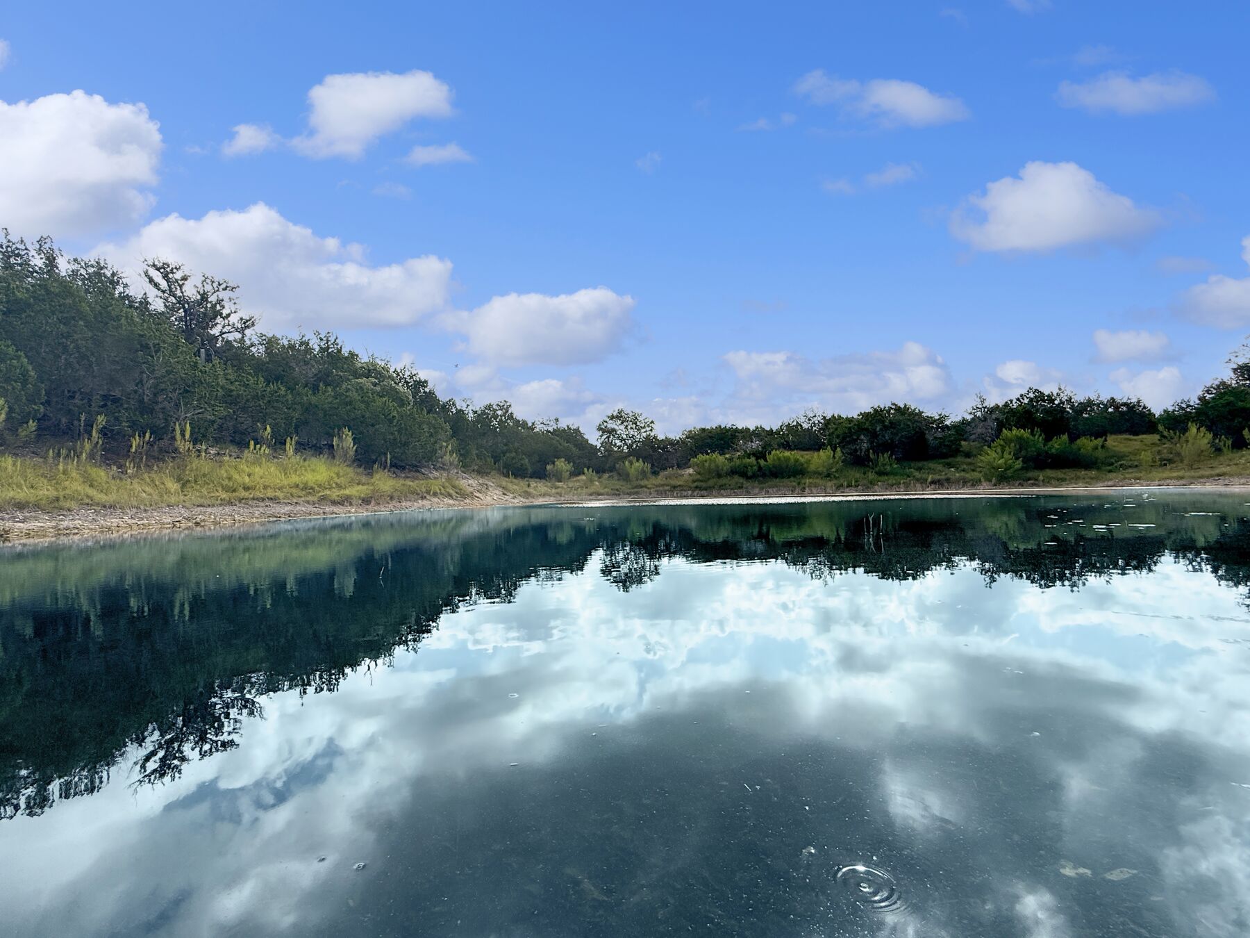
The pond is seasonal. Its level rises and falls through the year, and this page does not pretend otherwise: on 27 August 2025 it stood full to the bank, and six weeks later, on 10 October, the drone found it drawn well down with pale exposed shoreline ringing it on every side. Both dates are in the gallery below, one under the other. That is the honest picture of what a buyer is looking at.

How the land walks is worth saying plainly: it is walkable around the pond, and hike-able through the cedar thicket. This is not a tract that walks flat throughout. Cedar and live oak cover the western slope; a caliche track runs down the west side of the pond to the water.

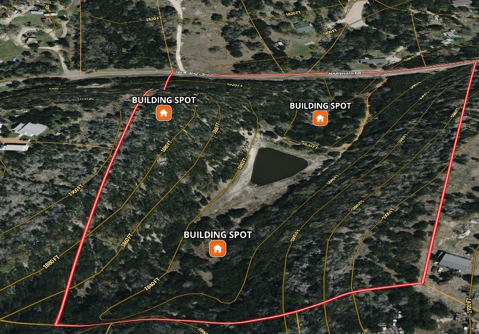
Nothing is built on it. There is no water and no sewer or septic on the tract; electricity is available. Fencing is partial. Access is off a county road with a chip-and-seal surface, and the property is gated. There are multiple potential building sites. There is no zoning, and manufactured housing is permitted.

About fifteen minutes to town, and about an hour to San Antonio.

  • 16.77 acres · MLS #F120128A · Kerrville South II, Kerr County · listed August 2025.
  • Seasonal pond — the level varies through the year, and two dated shoots on this page show it at both.
  • Wooded and secluded · partial fencing · chip-and-seal county road · electricity available, no water and no septic · no zoning, manufactured housing permitted.
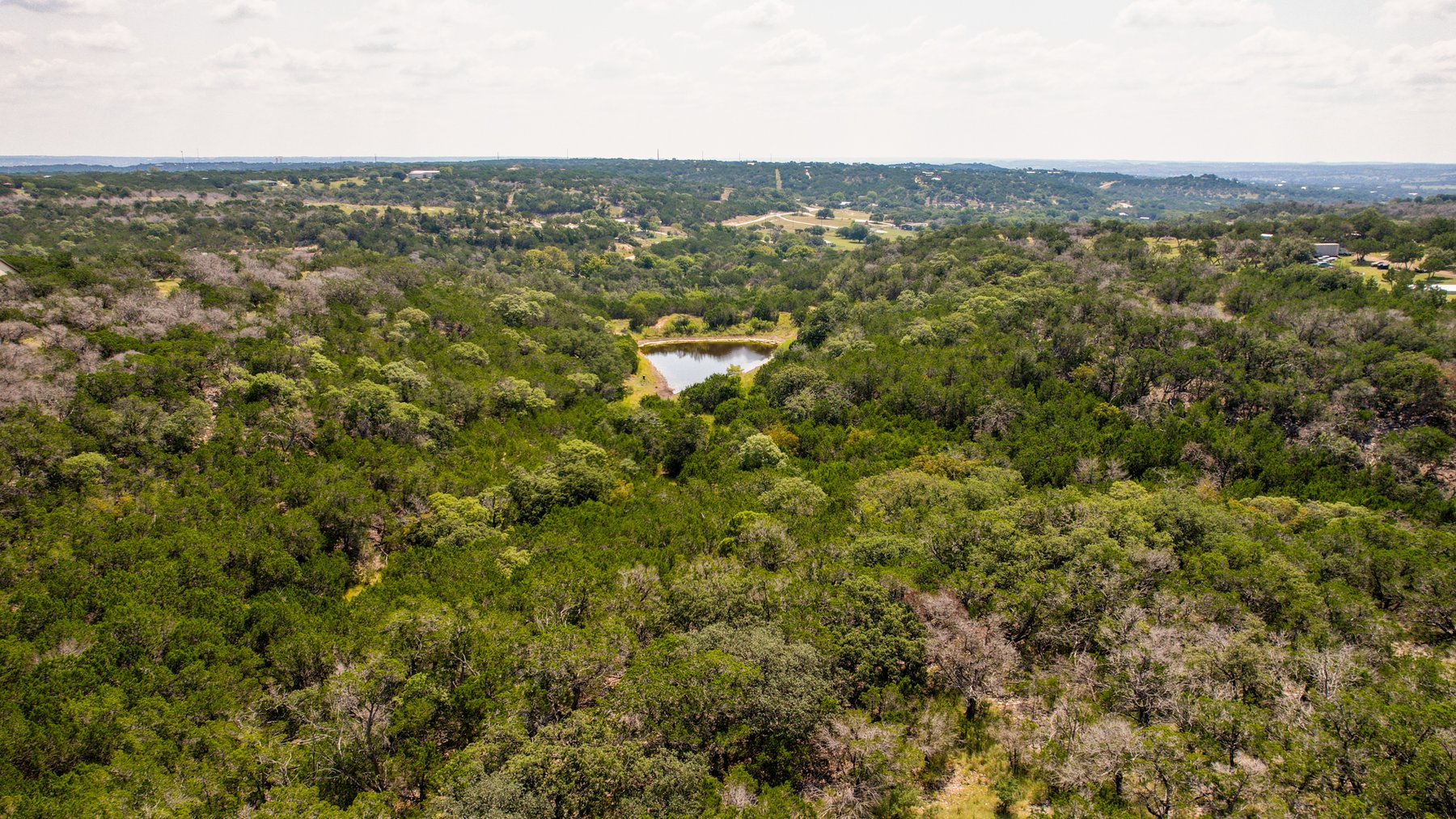
Aerial view at 230 Marshall Dr showing the pond sitting in a wooded bowl with the Hill Country running out to the horizon beyond the tract
The pond in its bowl, with the Hill Country running out to the horizon beyond the tract.

Property snapshot

What’s here, in plain numbers.

The land
16.77 acresWooded, secluded, exceptional view · Kerrville South II, Lots 27, 29 & 30 · multiple potential building sites · no buildings on the tract
The water
Seasonal pondA pond in the bowl below the west ridge. Its level rises and falls through the year — that is why every photograph on this page is dated. Visit it and ask about it in a dry spell.
Price
$299,000$17,829 per acre · listed August 2025 · will sell cash, conventional, FHA or VA · possession at closing and funding
Utilities
Electricity availableNo water and no sewer or septic on the tract · nothing is built · a buyer brings the rest
Access
County roadChip-and-seal surface · the property is gated · fencing is partial · a caliche track runs down the west side of the pond
Restrictions & zoning
Kerrville South IINo zoning · manufactured housing permitted · the recorded subdivision restrictions and their two supplements are published on this page · not in the city limits, and not in the ETJ
Taxes
$2,613.00Taxes without exemptions, source KCAD (appraisal district #30382) · Kerr County Area 42 — Kerrville South · Kerrville schools, buyer to verify
Minerals
UnknownThe listing record shows mineral rights as unknown. Nothing on this page implies any mineral interest conveys — a buyer should have title examined.
Suitable use
Farm, hunting, recreationalThe listing record also lists residential and subdevelopment · about 15 minutes to town, about an hour to San Antonio

The fine print on these numbers

Figures are from the confirmed listing record for MLS #F120128A, Active, listed August 2025, at the current list price of $299,000 — $17,829 per acre on 16.77 acres. The legal description is Kerrville South II, Lots 27, 29 and 30, 16.77 acres. The tax figure is the amount without exemptions from the Kerr County Appraisal District. Terms: cash, conventional, FHA or VA, with possession at closing and funding.

A buyer should independently verify acreage, boundaries, easements, taxes, minerals, restrictions and utilities. All measurements are approximate, and any boundary shown or described anywhere on this page is approximate and for illustration only — not a survey.

Photographs

The same pond, on two dates.

Fifteen frames from two shoots six weeks apart. Read the dates — they are the point. The pond is seasonal, and these are what it actually looked like on each of the two days.

A word on coverage, so nobody is surprised on site: twelve of these fifteen come from four camera positions during one drone descent into the pond bowl, and eight of those are crops of the four full frames. There is no photograph of the gate, the county road or the fence line in any source we hold, though the listing records all three. Nothing was invented to fill the gap. Ask at the showing, or walk it from the road.

10 October 2025 — the pond at its autumn level

Twelve frames from one afternoon. The pale ground ringing the water is exposed shoreline, not beach — the pond had drawn well down by October.

27 August 2025 — the same pond, full

Three frames taken six weeks earlier, from the ground. These are the frames that show the pond full to the bank. Set them against the October frames above and the word “seasonal” stops being a caveat and becomes a measurement. All three were retouched for colour and contrast by a third party; no object in any of them was added or removed. Each caption says so on its own.

When these were photographed, and what they do and do not show

Photography. Frames on this page were photographed 10 October 2025, except where a caption states 27 August 2025. The pond is seasonal and its level varies — full in the August frames, drawn down with shoreline exposed six weeks later in October. The three frames dated 27 August 2025 that are published with this listing were retouched by a third party for colour and contrast only; nothing in them was added or removed. The two shoots are roughly eleven months before this page.

The pond’s level is not a fixed feature of this property. It is described here as a seasonal pond and nothing else. The October frames show it drawn well down with exposed shoreline all the way round; the August frames show it full. A buyer visiting in a dry spell should expect the October picture, and should ask about the pond’s history before relying on it.

Twelve of the fifteen frames come from four camera positions during a single drone descent into the pond bowl, and eight of those are crops of the four full frames. There is no photograph of the gate, the county road or the fence line in any source we hold. Nothing was invented to cover the gap.

No boundary line is drawn on any photograph on this page or in the video tour. No map of the property is published here. Any boundary shown or described anywhere on this page is approximate and for illustration only — not a survey.

Location

Kerr County · Kerrville, TX 78028

South of Kerrville in the Kerrville South country — about fifteen minutes to town, and about an hour to San Antonio.

Kerrville, TX 78028Kerr County, Area 42 — Kerrville South
Kerrville South IILots 27, 29 & 30 · recorded subdivision restrictions apply
County roadChip-and-seal surface · gated property
Outside the cityNot in the city limits, and not in the ETJ

Boundaries, the survey and what is not published here

No map of the property is published on this page. No boundary line is drawn on any photograph, and none is drawn in the video tour. The only spatial document published for this listing is the survey from the seller’s file, listed with the other documents further down the page.

Any boundary shown or described anywhere on this page is approximate and for illustration only — not a survey. A buyer should have a current survey made and should verify boundaries, acreage, fencing and any easements of record independently. Fencing on this tract is partial.

The recorded Kerrville South II restrictions and their two supplements are published on this page as issued, so a buyer can read what runs with these lots rather than take a summary of it.

Due diligence

What a buyer should verify.

These are the things on this property a buyer will want to look into. They are on the page because a buyer would rather read them here than find them later.

Documents on file

Six documents are published on this page: the seller’s offer instructions, the survey, and the four recorded Kerrville South II restriction instruments. They are listed with measured page counts and file sizes further down, under Showings & how to offer. Anything else on file is available from the listing agent on request — email frontdesk@brokenarrowrealtygroup.com or call 830-383-2026.

Take it with you

The presentation and the feature sheet.

The property laid out to read on a phone or print — the numbers, the land and the pond, the dated photographs, the due-diligence list and the offer mechanics. The feature sheet is the same property on one page, sized to print or hand across a table.

Showings & how to offer

How to see it, and how to write on it.

Showing instructions

  • An appointment is required. Contact the listing agent to arrange access before you go out.
  • This is a gated property. There is no unaccompanied access — the listing agent lets you in.
  • Access is off a county road — chip-and-seal surface.
  • Wear boots and allow an hour or more. It is walkable around the pond and hike-able through the cedar thicket — this is wooded, secluded ground and it does not walk flat throughout.
  • Questions on the packet: email frontdesk@brokenarrowrealtygroup.com or call or text 830-383-2026.

How to submit an offer

The seller’s offer instructions are published with this listing; read them before you write. This applies to buyer’s agents only. Unrepresented buyers can contact Broken Arrow Group directly at 830-383-2026.

Documents

These are the documents published for this property. The four restriction instruments are recorded documents from the Kerr County public records and are provided for reference only — they are not a title commitment, and a buyer should have title examined independently. Anything else on file is available from the listing agent on request.

Terms: cash, conventional, FHA or VA, with possession at closing and funding. This is raw land — there are no buildings, no water and no septic on the tract, and electricity is available. The feeder, the box blind and the pop-up ground blind do not convey, and nothing else on the tract conveys except as confirmed in the contract.

Come take a look

Let’s go take a look.

You bring the dream. We have the land.

Call or text and we’ll set a time to walk it. Photographs only go so far on sixteen and three-quarter wooded acres with a seasonal pond in the middle — plan on boots and an hour, and if you’re driving in from out of town, tell us and we’ll work around the drive.

David Hughes
TREC #501321
Jayden Hughes
TREC #728099