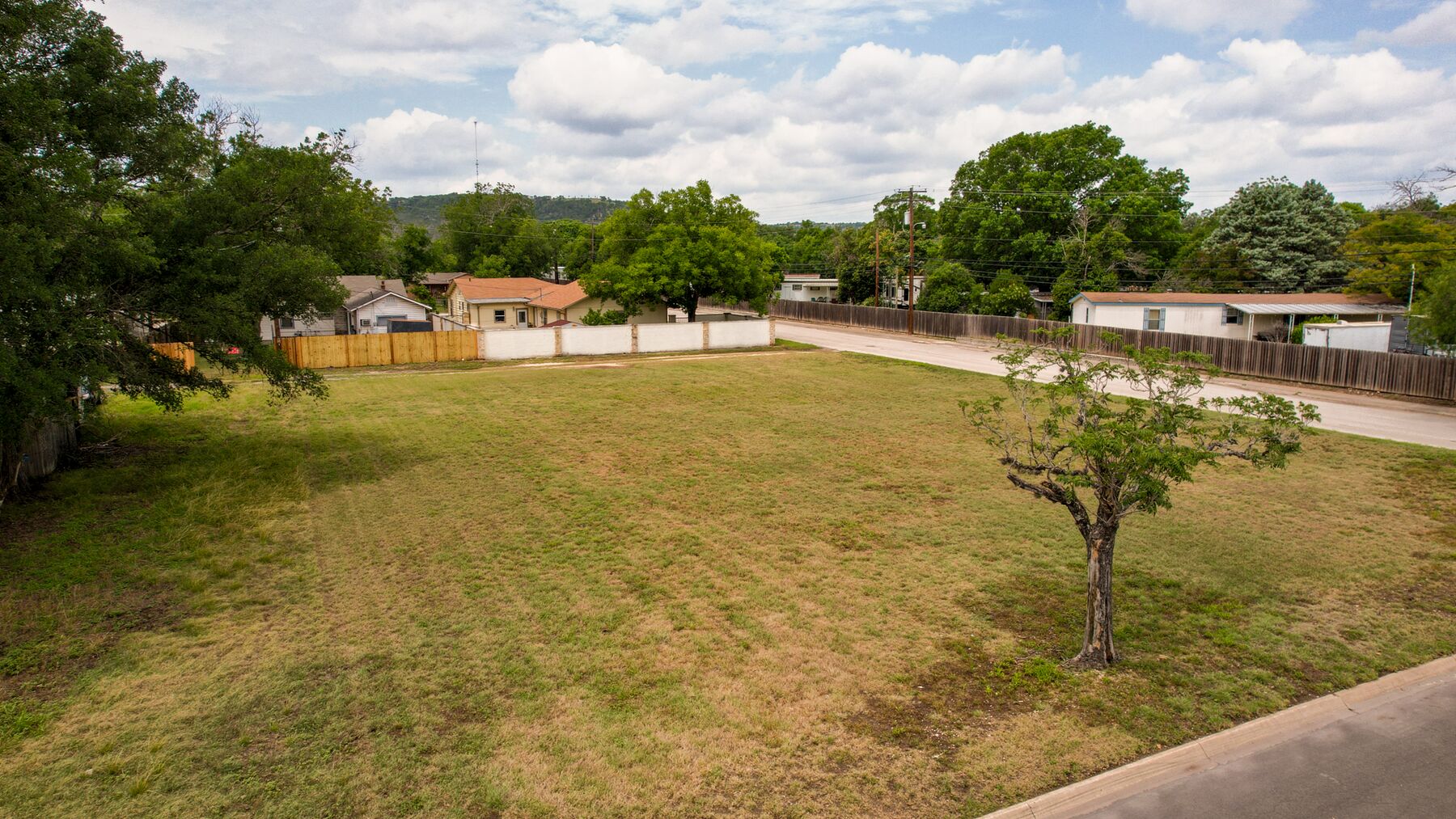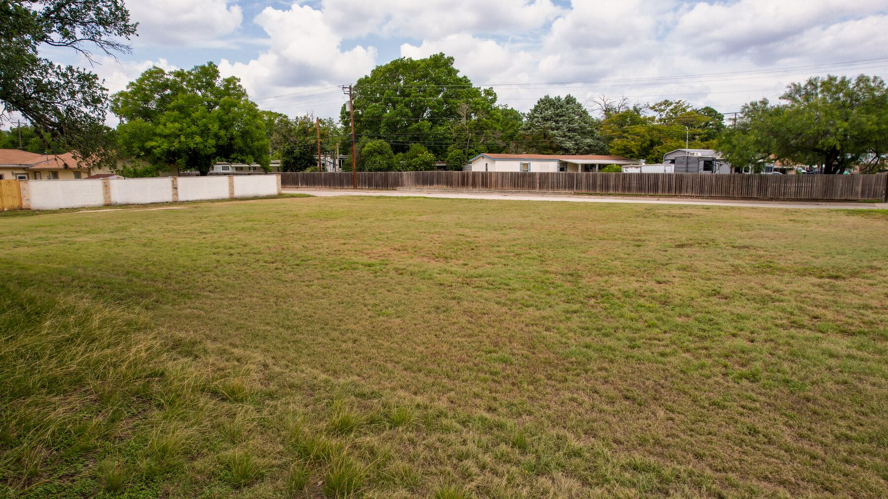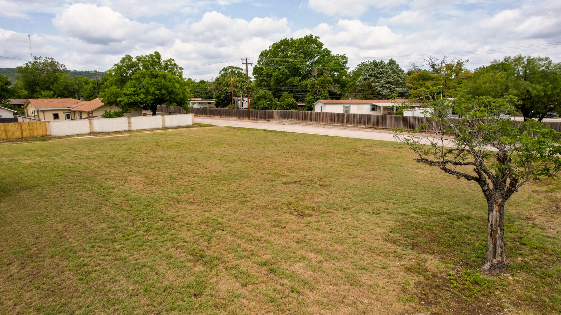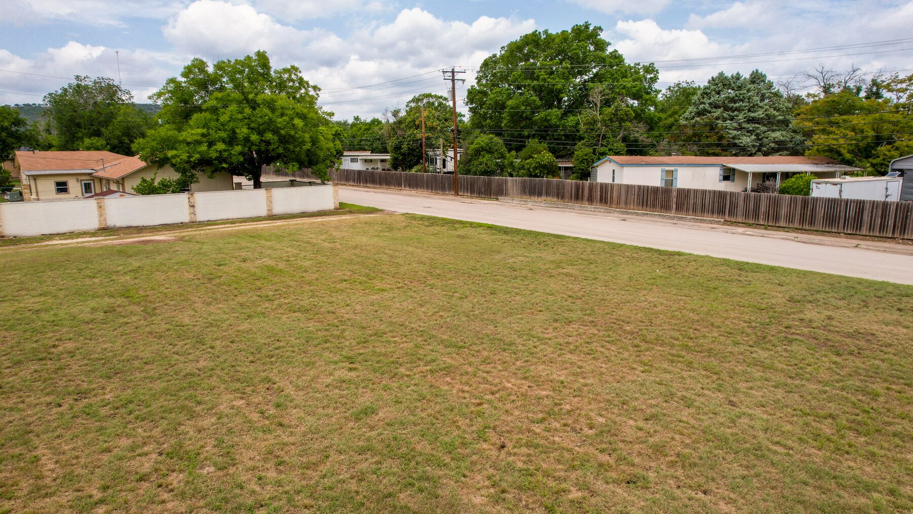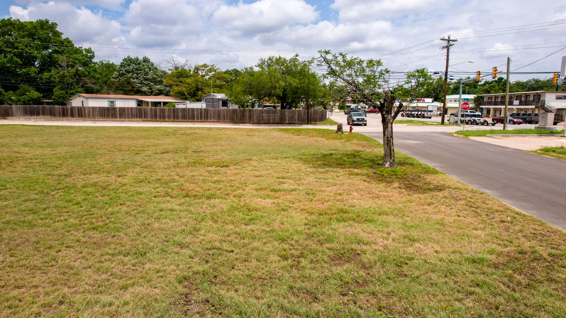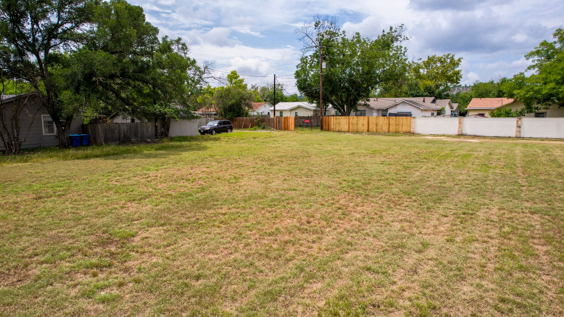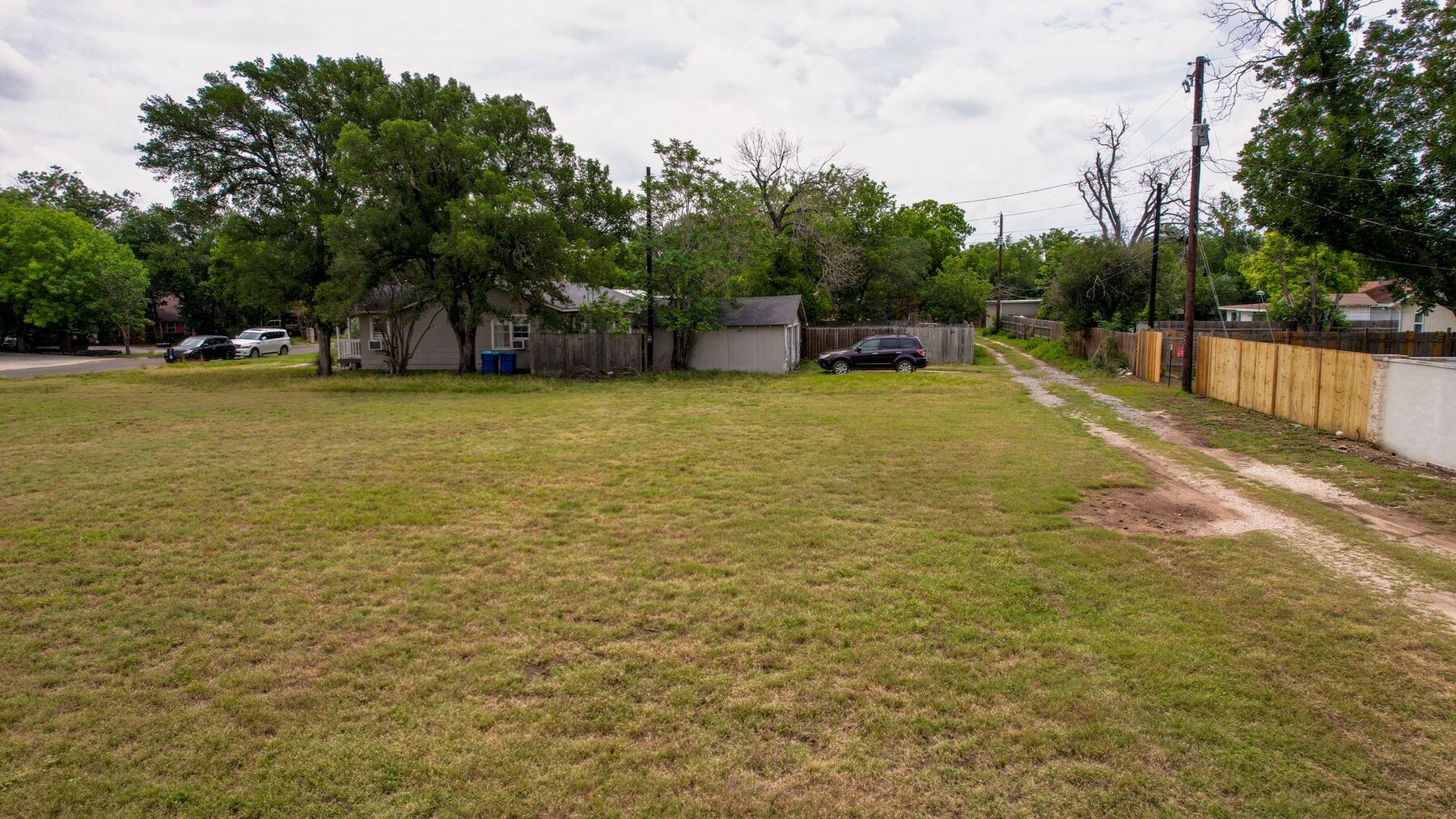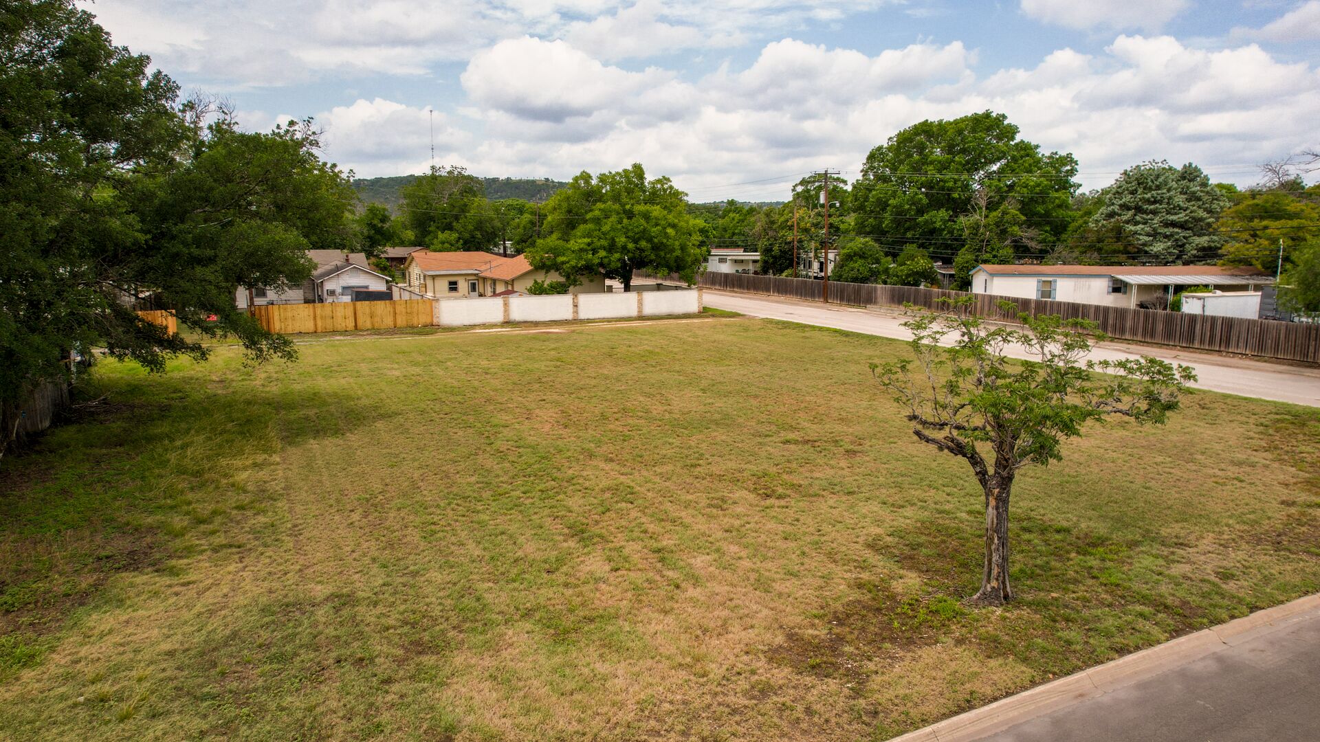
Elevated view across the open, level, mown ground at 519 Lucille St, with a single mature tree standing near the pavement and houses beyond the far edge

Kerr County · Kerrville, Texas · Westland

519 Lucille St

Two platted lots, held as one parcel — about four-tenths of an acre inside town

Level, open, mown ground on a paved street inside Kerrville. It is one conveyable parcel under a single appraisal-district account, made up of two platted lots offered together. The City zones it R‑1A — single-family residential with an accessory dwelling unit — and this page explains what that district allows and publishes the ordinance itself.

$175,000
List price
±0.40 acre
One parcel, two platted lots
R-1A
City of Kerrville zoning
L119769A
MLS number

The property

Approximately four-tenths of an acre, in town, with nothing on it.

This is a piece of open ground inside Kerrville rather than acreage out of town — mown grass, level across its whole width, with paved city street along two sides and neighbouring houses close by on the others.

Nothing is built on it. There is no house, no slab, no drive and no fence on the street sides; a neighbour’s white masonry wall runs along one boundary and wood fences close the back. One mature tree stands near the pavement. In the photographs the grass is mid-summer and partly dormant, and the sky is flat overcast throughout — they were all taken on one visit.

It is one parcel, and that is worth being precise about. The land is two platted lots — Lots 11 and 12 of Block 23, Westland — but they are held and offered together as a single conveyable parcel under one Kerr County Appraisal District account. That is one tax bill and one deed, not two lots you could sell separately. The line between the two platted lots is a line on the recorded plat; it does not divide the parcel, and nothing on the ground marks it. Together they come to approximately 0.40 acre, and our own listing remarks say acreage is to be verified — so treat the figure as approximate and check it.

The zoning is the first thing to read, not the last. The City of Kerrville zones this parcel R‑1A: single-family residential with an accessory dwelling unit. What that district permits is set out plainly further down this page, in the City’s own words, with the ordinance and the Land Use Table published as PDFs. If you have a particular use in mind, read them and speak to the City’s Planning Department before you write an offer.

The listing came to market in July 2025 and is offered at $175,000.

  • Approximately 0.40 acre · MLS #L119769A · Westland, Kerr County · listed July 2025.
  • Two platted lots — Lots 11 and 12, Block 23 — held as one parcel under a single Kerr CAD account. Not two separately conveyable lots.
  • Zoned R‑1A by the City of Kerrville · the ordinance and Table 1, the Land Use Table, are published on this page.
  • Level, open, mown ground · no structures · paved city street on two sides · a platted alley at the rear, per the published survey.
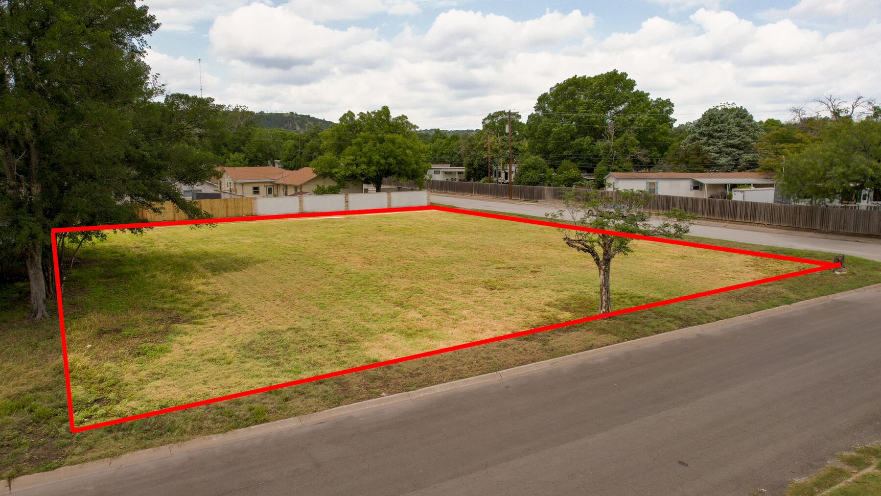
Elevated view of the open ground at 519 Lucille St with the property outline drawn in red, enclosing one continuous area between two paved streets
The property with its outline drawn in red by the listing photographer. The line encloses one continuous area — it is not a division of the parcel. Approximate and for illustration only — not a survey.

Property snapshot

What’s here, in plain numbers.

The land
±0.40 acreApproximately four-tenths of an acre · level and open · no structures · acreage is to be verified by the buyer
Parcel
One parcelTwo platted lots — Lots 11 and 12, Block 23, Westland — held together under a single Kerr CAD account. Not two separately conveyable lots and not two homesites.
Zoning
R-1ACity of Kerrville — single-family residential with an accessory dwelling unit, Code of Ordinances Sec. 60-50(c). The ordinance and Table 1 are published on this page. Confirm your intended use with the City before you write.
Price
$175,000Listed July 2025 · no price per acre is quoted here, because the acreage it would be derived from is itself to be verified
Taxes
$1,818.54The appraisal district’s 2025 estimate without exemptions — the buyer-relevant figure. The current owners’ exemptions do not transfer. 2025 values are preliminary; verify with Kerr CAD.
Utilities
Not stated hereWe are not publishing a utility claim on this parcel, because we do not hold a verified source for one. The photographs prove nothing about utilities — no tap, meter or service connection appears in any frame. Confirm availability, capacity and connection costs with the City and the providers.
Access
Paved city streetsThe published survey and parcel map show the property with Lucille St along one side and Woodlawn Ave along another, and a platted alley at the rear
Legal & account
Westland Blk 23Legal description WESTLAND BLK 23 LOT 11, 12 · Kerr CAD Property ID 40597, Geographic ID 6840-0230-011000 · Kerrville, Kerr County, Texas

The fine print on these numbers

Figures are from the confirmed listing record for MLS #L119769A, Active, listed July 2025, at the current list price of $175,000. The legal description is WESTLAND BLK 23 LOT 11, 12, carried under a single Kerr County Appraisal District account. Size is approximately 0.40 acre and is to be verified — our own listing remarks say so.

No frontage figure and no lot dimension is printed anywhere on this page, and that is deliberate. Three of our sources give three different answers and they do not reconcile, so rather than choose one we publish the surveyor’s drawing and the recorded plat and let a buyer read the figures from the documents themselves. The survey is the right home for a measurement; a marketing page is not.

The tax figure is the appraisal district’s estimate without exemptions, which is the number a buyer should plan around; the current owners’ exemptions do not transfer with the property. A buyer should independently verify acreage, boundaries, easements, taxes, zoning, permitted use and utilities. All measurements are approximate, and any boundary shown or described anywhere on this page is approximate and for illustration only — not a survey.

Zoning — read this before you write

R-1A: a house, and one accessory dwelling unit.

The City of Kerrville zones this parcel R‑1A — single-family residential district with accessory dwelling unit, at Code of Ordinances Sec. 60-50(c). We would rather you knew exactly what that means now than found out after a trip, so here it is in plain words, with the City’s own text beside it and the full ordinance published below.

In plain words. This is a residential district. It allows a single-family detached house, plus no more than one accessory dwelling unit — and that second unit can be inside the main house or in a detached structure on the same lot. Only one main building goes on a lot, with the ordinance’s own exceptions for a detached garage, guest quarters, a detached structure holding the accessory dwelling unit, or another lawful accessory structure. The ordinance caps that accessory dwelling unit’s own floor area at one-half of the main dwelling’s floor area, and where the unit is detached it caps it again at 50 percent of the rear yard area.

A garage or a workshop is an accessory building. The ordinance permits accessory buildings and caps them. Where an accessory building or structure extends into a required side or rear setback, the ordinance limits it to 1,000 square feet of floor area and 15 feet in height, and no closer than five feet to any property line. It also caps all accessory buildings on a lot together at 50 percent of the rear yard area. Those are the ordinance’s numbers, not ours.

What this page does not print, and why. No setback, parking, lot-size, lot-width or building-height figure appears anywhere on this page. Two copies of Sec. 60-50(c) are available to us — the City’s current online code, and the copy filed with this listing and published below — and they do not agree on all of those numbers. Rather than print a figure that may be superseded, this page prints none. Read them in the published ordinance, and take any figure your plans turn on from the City of Kerrville Planning Department in writing.

The definitive list of uses is Table 1, the Land Use Table — a City document adopted by ordinance, which sets out use by use what is permitted in each district, what needs a conditional use permit, and what is not permitted. It is published on this page in full. Anything beyond a residential use — including any commercial use — is a question for the City, and this page makes no representation about it either way.

So: confirm your intended use with the City of Kerrville Planning Department before you write an offer. They are the authority on what this district allows on this parcel. Nothing on this page is legal advice, nothing on it predicts what the City would decide, and nothing on it should be taken as a promise about any use.

This is on the page as a qualifying feature. Reading it now costs a few minutes; finding it out later costs a drive.

“The R‑1A district is similar to the R‑1 district, allowing for single-family detached homes, but also permitting an accessory dwelling unit in addition to the primary residence. The accessory dwelling unit may be located within the main building or in a detached structure on the same lot as the main building.”

City of Kerrville Code of Ordinances, Sec. 60-50(c)(1)

“An accessory building or structure, including, but not limited to, a detached carport or garage, with a floor area not exceeding 1,000 square feet and not exceeding 15 feet in height, may extend into the required side or rear setback, but in no case shall be located closer than five feet from any property line.”

“The total square footage of all accessory buildings or structures on a lot shall not exceed 50 percent of the rear yard area…”

City of Kerrville Code of Ordinances, Sec. 60-50(c)(7)

The three documents, published in full

The ordinance — Sec. 60-50(c) as issued, including the lot, setback, height and parking requirements this page does not reproduce. Open the PDF.

Table 1, the Land Use Table — the definitive list of what is permitted, what is conditional and what is not, district by district. Open the PDF.

The City’s zoning map — a capture of the City of Kerrville public property map with this parcel marked and the R‑1A legend entry circled. The marks on it are ours; the map and its districts are the City’s. It carries no capture date, so treat it as a snapshot and confirm the current district with the City. Open the PDF.

Photographs

Eight frames, and what they do not show.

Eight photographs of the property, all from a single visit under flat, bright overcast. They are published exactly as delivered — resized and stripped of metadata, with no colour grade, no sky replacement and no retouching of any kind.

A word on coverage, so nobody is surprised on site. There is no ground-level frame taken from the street looking at the property the way you would first see it on arrival, no frame that establishes the street corner, and no frame that shows the two platted lots as two — nothing on the ground marks that line, so no photograph can show it. There is also no photograph of a water tap, meter, sewer connection or service drop, so this set proves nothing at all about utilities. Nothing was invented to fill those gaps. The documents further down the page — the survey, the plat, the parcel map and the aerial — are what answer the spatial questions.

About these photographs, and the limits of this set

No photography date is stated on this page, and that is on purpose. The files carry an export timestamp rather than a capture time, and every piece of camera metadata was stripped before they were delivered to us — so there is no recoverable date on which these were taken, and we will not invent one. What can be said safely is this: no frame in the set is newer than July 2025, which makes every one of them at least fourteen months old at the time of writing. Nothing visible in them has obviously changed since, but nobody has verified that.

This is the whole publishable set — eight frames from one visit. Three further frames were not published: each is dominated by a neighbouring commercial strip across the street, and one carries another business’s name and telephone number on a legible sign. Publishing another business’s identity on our listing page is not ours to do. No frame was retouched to make it publishable — where something could not be published, the frame was dropped rather than edited.

What this set does not show: no ground-level street-frontage view; no frame establishing the street corner; no frame showing the two platted lots as two; no overhead or plan-view aerial; no corner pins or survey stakes on the ground; no utility tap, meter or service connection of any kind, so the photographs prove nothing about utilities; nothing showing grade or drainage; and no second season, no second visit and no clear-sky frame. Where the photographs cannot answer a question, the documents published below may, and the City and a current survey certainly can.

The red outline on the second frame was drawn by the listing photographer and has never been checked against the survey, the plat or any appraisal-district record. It shows shape only, it encloses one continuous area, and it is not a map, a survey or a plat. Approximate and for illustration only — not a survey.

Location

Kerrville, TX 78028 · Westland

In town rather than out of it — a platted city block in the Westland addition, on paved streets, inside the Kerrville city limits and within the City’s zoning jurisdiction.

Kerrville, TX 78028Kerr County · Westland
Westland, Block 23Lots 11 and 12, held as one parcel
Paved city streetsLucille St and Woodlawn Ave, with a platted alley at the rear
Inside the cityZoned R-1A by the City of Kerrville

The boundary documents, and what each of them is

Four spatial documents are published on this page, and they are listed with the others further down. The survey is a registered professional land surveyor’s drawing of Lots 11 and 12 with his own bearings and distances on it — it carries no date, so read it as an existing drawing rather than a current one. The plat is an excerpt of the recorded subdivision plat showing the block layout, with the two lots marked by hand; it is a partial capture rather than a complete recorded sheet. The appraisal district’s parcel map shows the property as a single parcel, which is the clearest picture there is of the two-platted-lots-one-parcel fact. The aerial is a plan-view photograph with a boundary drawn over it by a mapping service.

Any boundary shown or described anywhere on this page — in a document, on a photograph, or in words — is approximate and for illustration only, not a survey. The appraisal district’s map carries that warning in its own words, and so does the aerial’s publisher. A buyer should have a current survey made and should verify boundaries, acreage and any easements of record independently.

Due diligence

What a buyer should verify.

These are the things on this property a buyer will want to look into. They are on the page because a buyer would rather read them here than find them later — and on this listing, the first one is the one that matters most.

Documents on file

Seven documents are published on this page: the survey, the recorded plat excerpt, the appraisal district’s parcel map, an aerial with the boundary drawn on it, the R‑1A ordinance, the City’s Land Use Table and the City’s zoning map. They are listed with measured page counts and file sizes under Showings & how to offer. Anything else on file is available from the listing agent on request — email frontdesk@brokenarrowrealtygroup.com or call 830-383-2026.

Take it with you

The presentation and the feature sheet.

The property laid out to read on a phone or print — the numbers, the ground, the R‑1A explanation, the photographs and their limits, the due-diligence list and the offer mechanics. The feature sheet is the same property on one page, sized to print or hand across a table.

Showings & how to offer

How to see it, and how to write on it.

Showing instructions

  • An appointment is required. Contact the listing agent to arrange access before you go out.
  • It is open, level ground with nothing built on it. Allow time to walk the whole of it and to look at how it sits against the neighbouring properties.
  • Read the zoning before the visit, not after. The R‑1A ordinance and the City’s Land Use Table are published on this page, and the City of Kerrville Planning Department is the authority on what the district allows here.
  • Questions on the packet: email frontdesk@brokenarrowrealtygroup.com or call or text 830-383-2026.

How to submit an offer

Contact the listing agent for offer instructions before you write. This applies to buyer’s agents only. Unrepresented buyers can contact Broken Arrow Group directly at 830-383-2026.

  • Email offers to frontdesk@brokenarrowrealtygroup.com, then call or text 830-383-2026 so we know it landed.
  • Do your zoning homework first. If your plans depend on a particular use, confirm it with the City of Kerrville Planning Department before you write — not after.

Documents

  • Survey — Lots 11 & 12, Block 23 (PDF, 1 page, 0.6 MB) A registered professional land surveyor’s drawing of the two lots, with his bearings, distances and found and set markers on it, published as issued from the seller’s file. It carries no date — read it as an existing drawing, not a current one. A buyer should have a current survey made, and any boundary shown or described anywhere on this page is approximate and for illustration only, not a survey.
  • Recorded plat — Westland Place Addition, excerpt (PDF, 1 page, 0.9 MB) An excerpt of the recorded subdivision plat showing the block and lot layout, with the two lots marked by hand. It is a partial capture, not the complete recorded sheet, and it carries no recording certificate. The survey names the recorded volume and page for anyone who wants the full instrument from the county.
  • Appraisal district parcel map (PDF, 1 page, 0.3 MB) The Kerr County Appraisal District’s web map, dated on its face 31 May 2025, with the property outlined as a single parcel among its neighbours. This is the clearest illustration of the two-platted-lots-one-parcel fact. The district’s own disclaimer on the sheet says it is for informational purposes only, does not represent an on-the-ground survey, and shows only the approximate relative location of boundaries.
  • Aerial with boundary (PDF, 1 page, 0.7 MB) A plan-view aerial photograph of the property with a boundary drawn over it by a third-party mapping service, published as issued. It is the only overhead view of the ground on this page. Approximate and for illustration only — not a survey, and its publisher gives no warranty as to completeness or accuracy.
  • R-1A zoning ordinance — Sec. 60-50(c) (PDF, 3 pages, 0.2 MB) The City of Kerrville Code of Ordinances section for the R‑1A district, as issued from the municipal code. It carries the district’s purpose and permitted uses, the lot size, width, setback, height and parking requirements, and the accessory-building and accessory-dwelling-unit rules. This is the document; everything this page says about zoning comes from it.
  • Table 1 — City of Kerrville Land Use Table (PDF, 4 pages, 0.2 MB) The City’s definitive use table, adopted by ordinance, setting out use by use what is permitted, what requires a conditional use permit and what is not permitted in each zoning district including R‑1A. If your plans depend on a particular use, this is the table to read — and then to confirm with the City’s Planning Department.
  • City of Kerrville zoning map — this parcel (PDF, 1 page, 3.8 MB) A capture of the City’s public property map showing the parcel and the zoning districts around it, with the R‑1A legend entry circled. The callout and the circle are our marks; the map and its district colours are the City’s. It carries no capture date, so treat it as a snapshot and confirm the current district with the City.
  • The full presentation (PDF, 9 pages, 8.5 MB) The whole property, laid out to print or forward.
  • Feature sheet (PDF, 1 page, 1.5 MB) The property on one page — the numbers, the zoning note and the verify list.

These are the documents published for this property. The survey, plat, parcel map and aerial are provided for reference only — they are not a title commitment and none of them is a current survey, and a buyer should have title examined and a survey made independently. The zoning documents are the City of Kerrville’s, published as issued; the City, not this page, is the authority on what the district allows here. Anything else on file is available from the listing agent on request.

There is no video tour and no 3D tour for this property, and no offer-instructions document to publish — none of them exists, and nothing was substituted for any of them. This is raw, unimproved land: nothing is built on it and nothing stands on it that conveys. What conveys is the land itself, as confirmed in the contract.

Come take a look

Let’s go take a look.

You bring the dream. We have the land.

Call or text and we’ll set a time to walk it. Eight photographs from one overcast afternoon only go so far on a piece of open ground in town — and if what you have in mind depends on the zoning, tell us early and go to the City with it before you write. That conversation is worth more than any picture on this page.

David Hughes
TREC #501321
Jayden Hughes
TREC #728099